

44 iconic stops around Route 1 — choose your highlights for a 7–14-day Iceland road trip.
Iceland's Ring Road is about 1,332 km before detours. This guide includes 44 classic stops, from the South Coast waterfalls and glacier lagoons to the Eastfjords, Mývatn, Goðafoss and West Iceland. The full list is a menu of places to choose from, NOT a checklist for one trip: 'Core' highlights are the biggest sights and 'Extra' stops are optional, often requiring extra driving or hiking. Seven days means selecting just a few stops per day; 10–12 days suits most first-time visitors, while 14 days leaves more room for walks, tours and weather changes. Route 1 itself is not an F-road and normally does not require a 4x4 in good summer conditions.
冬季の注意
Route 1 is a year-round road, but winter storms can close sections temporarily and make a fixed multi-day schedule unsafe. Use a winter-ready vehicle, check road and weather conditions every day and keep accommodation plans flexible where possible.
必見
主な見どころ
South Coast & Glacier Lagoons
Waterfalls, black beaches, glaciers and Jökulsárlón form the most sight-dense early section of the loop.
East Iceland
Long fjord drives and Egilsstaðir provide a slower transition between the south and the volcanic north.
Mývatn & North Iceland
Volcanic landscapes and Akureyri reward travellers who avoid compressing the north into a single transit day.
ルート沿い
立ち寄り先とハイライト
必見スポット44か所


Selfoss
As seen in the image, Selfoss is characterized by the majestic Ölfusá River, flowing broad and grey-green through its heart, spanned by a distinctive suspension bridge that connects its bustling sides. This strategic location makes it a natural stop, boasting a lively town center with shops, restaurants, and a growing cultural scene. Beyond its role as a service town, Selfoss offers a glimpse into authentic Icelandic life, blending modern amenities with the raw beauty of its natural surroundings. The town provides a comfortable and convenient gateway to some of Iceland's most iconic landscapes, from geysers to waterfalls, all within easy reach.
サウスコーストへ向かう前の、各種サービスと食事に便利な立ち寄り先です。


Stuðlagil
Carved by the powerful Jökla river, Stuðlagil boasts some of the most impressive basalt column formations in the world, rising dramatically from the clear blue waters. The striking contrast between the dark, geometric rock formations and the brilliant blue-green river creates a surreal landscape that feels otherworldly. Visitors can marvel at the sheer scale of the columnar walls, which seem to defy gravity, and explore the canyon floor for an immersive experience that's a photographer's dream. The serene yet powerful atmosphere makes it an unforgettable stop on any Icelandic adventure.


Borgarnes
Borgarnesは、Borgarfjörður(ボルガルフィヨルド)に面したアイスランド西部の居心地のよい町で、長い橋で結ばれています。カラフルな家並みと海岸や山々のパノラマが広がり、ヴァイキングゆかりの歴史で知られるほか、この地域やSnæfellsnes半島を巡る拠点としても最適です。
Reykjavík へ戻る前、またはオプションの Snæfellsnes 延長の前の、西アイスランド最後の主要なサービス立ち寄り先です。
デイプラン
おすすめ旅程
Day 1
Reykjavík → South Coast / Vík
Waterfalls and black-sand coast; do not overfill the arrival day.
Day 2
Vík → Skaftafell → Jökulsárlón → Höfn
One of the most sight-dense days; keep time for the glacier-lagoon area.
Day 3
Höfn → Eastfjords → Egilsstaðir
Expect slower fjord driving than the distance suggests.
Day 4
Egilsstaðir → Mývatn
Choose Dettifoss only if road, daylight and pace make the detour realistic.
Day 5
Mývatn → Akureyri
Spend meaningful time around Mývatn before an easy transfer to Akureyri.
Day 6
Akureyri → Northwest Iceland
Use the day for selected towns and services rather than chasing every side route.
Day 7
Northwest → Borgarnes → Reykjavík
Fast-loop finish; longer itineraries should insert extra days in the south, east and north.
セルフドライブプラン
そのほかの旅程プラン
スケジュールに合ったプランを選びましょう。
7-Day Fast Ring Road
7 daysA highlights loop with long driving days and limited weather margin.
Fast 7-day sample: choose only the highlights you have time for; the 44-stop full catalogue is not a seven-day checklist. Expect long drives, limit excursions and adapt to weather.
Recommended 10–12 Day Ring Road
10–12 daysBest balance for a first trip, adding time for South Coast walks, East Iceland, Mývatn and North Iceland without constant long drives.
Recommended first Ring Road trip. Core attractions and selected side trips; choose walks and detours to match each day's driving and conditions.
14-Day Relaxed Ring Road
14 daysAdds weather margin, activities, hikes and regional side trips without making every day a transfer.
Full Ring Road stop catalogue with extra walks and optional detours. These are choices, not 44 mandatory visits. Golden Circle and other longer excursions require separate days.
出発前に
実用情報
旅の所要日数
Recommended 10–12 days · 7 days fast · 14 days relaxed
出発地
Reykjavík
ベストシーズン
May–September gives the easiest driving and longest daylight. The Ring Road is a year-round main road, but winter adds short daylight, storms, ice and a greater risk of temporary closures, so winter itineraries need substantially more flexibility.
道路状況
Route 1 is the main paved ring road and is normally suitable for a standard 2WD in good summer conditions. Optional F-road detours are separate and require an appropriate permitted 4x4.
天気
Weather can change dramatically between regions on the same day. Check the forecast for the next driving section rather than relying on conditions at your current hotel.
給油
Fuel is widely available, but service gaps are much longer in parts of East and North Iceland. Refuel regularly and before remote stretches.
食事
Towns around the route have good options, but carry snacks and water for long rural driving days and check opening hours outside summer.
駐車
Use designated attraction, town and trail parking throughout the route. Never stop on Route 1 or narrow shoulders for photographs.
トイレ
Facilities are available in towns, fuel stations and major visitor sites, but long rural sections may have few services.
安全
Do not drive when fatigue, severe wind, snow or closures make the next section unsafe. Never drive off-road, and keep optional F-road excursions separate from the standard Ring Road plan.
バリアフリー
Accessibility varies by stop: towns and major viewpoints can be easy, while beaches, waterfalls, glacier areas and trails may involve uneven ground.
冬の運転
Use proper winter tyres and a vehicle suited to current conditions. A 4x4 can help in difficult weather but does not make a closed or storm-affected road safe.
営業時間
Route 1 itself is a public road; attractions, museums, baths and activities have individual opening hours and seasonal schedules.
今すぐ予約
ツアーとアクティビティ
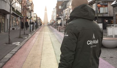 2 hours 30 minutes
Private Walking tour Reykjavik - CityWalk
CityWalk Reykjavik
から
48,000 ISK
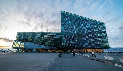 4 hours
Private Reykjavík Sightseeing Tour 4hrs
Your Transfer ehf
から
75,858 ISK
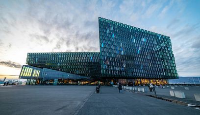 6 hours
Private Reykjavík Sightseeing Tour 6hrs
Your Transfer ehf
から
113,855 ISK
 5 hours
The Icelandic Christmas Advent Driving Tour
Your Friend in Reykjavik
から
153,900 ISK
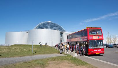
City Sightseeing & Wonders of Iceland
Reykjavik Excursions by Icelandia
から
12,999 ISK
 55 minutes
Lava Show in downtown Reykjavík - Classic & Premium Experience
Lava Show
から
6,590 ISK
地元の知識
旅行のヒント
Allow 10–12 days for a comfortable first Ring Road trip; 7 days is possible but leaves little weather flexibility
Check current road conditions and the weather forecast before every driving day, especially outside summer
A standard 2WD is normally sufficient for Route 1 in good summer conditions; F-road detours require an appropriate 4x4
Refuel before long rural sections, particularly in East and North Iceland
Keep at least some itinerary flexibility because wind, snow or road closures can change driving plans quickly
Book accommodation and popular activities well ahead for the main summer season
リングロード周遊のレンタカーを探す
人数と道路状況に合った快適な車を選びましょう。GoIceTravelで空き状況を確認し、出発前には最新の道路情報と天候を必ず確認してください。
- ミドル / ファミリー
検索すると利用可能な車が表示されます
荷物を積んだリングロードの長距離ドライブも快適。
車を探す - SUV
検索すると利用可能な車が表示されます
最低地上高が高く、安定した走り。
車を探す - 4WD / AWD
検索すると利用可能な車が表示されます
ハイランドの Fロードや厳しい冬の路面に。
車を探す - プレミアム / ラグジュアリー
検索すると利用可能な車が表示されます
最高クラスの快適さと装備でドライブを。
車を探す
検索前のカテゴリー画像は DiscoverCars 提供の参考例であり、リアルタイムの空車ではありません。実際の車と料金は日程を指定した検索で表示されます。GoIceTravel が手数料を受け取ることがありますが、お客様の追加負担はありません。
周辺
周辺の観光スポット

Seljalandsfoss
Seljalandsfoss(セリャランズフォス)は、アイスランド南海岸にある高さ約60メートルの滝です。条件が整うときには滝の裏を通る小道が開放されており、落ちる水のカーテン越しに周囲の低地を眺めるという、ほかにはない体験ができます。

Skógafoss
Skógafoss(スコゥガフォス)は、Skógar近くのSkógá川にかかる高さ約60メートルの滝です。かつての海食崖から幅広い水のカーテンが流れ落ち、東側の階段を上ると滝の上の展望台に出ます。

Reynisfjara 黒砂海岸
Reynisfjaraは、ヴィーク・イ・ミールダル近くにあるアイスランド最も有名な黒砂海岸です。玄武岩の柱状節理とReynisdrangarの海食柱を背景に息をのむ絶景が広がります。一方で、予告なく押し寄せる「スニーカーウェーブ」と呼ばれる危険な波で知られており、警告システムに従って波打ち際から十分な距離を保つことが重要です。

Fjaðrárgljúfur 峡谷
Fjaðrárgljúfurは、Kirkjubæjarklaustur近くにある蛇行した峡谷で、Fjaðrá川が層状の岩を削って形成しました。縁に沿った遊歩道と展望台から渓谷を見下ろせます。

Skaftafell自然保護区
Skaftafellは、Vatnajökull国立公園内にある主要なビジターエリア兼ハイキングエリアです。滝や氷河の眺め、山岳地形へと続くトレイルが整備されています。

Jökulsárlón 氷河湖
Jökulsárlónは、アイスランド南東部のBreiðamerkurjökull氷河の端にある氷河湖です。氷河から崩れた氷山が湖を漂い、やがて流出口から大西洋へと流れ出します。

Breiðamerkursandur(ダイヤモンドビーチ)
Breiðamerkursandur(通称ダイヤモンドビーチ)は、Jökulsárlónのそばに広がる黒砂の海岸です。湖から大西洋へ出た氷山のかけらが浜辺に打ち上げられることがあります。

Stokksnes
Stokksnesは、アイスランド東部にある黒砂海岸で、劇的な海岸風景で知られています。暗い火山砂の浜からは、そびえ立つVestrahorn山の雄大な姿を望め、穏やかな潮だまりに映り込む光景が有名です。

Seyðisfjörður
Picturesque Eastfjords town known for colourful wooden houses, a strong arts scene, mountain scenery and its international ferry connection.

Dettifoss
Witness Dettifoss, Iceland's most powerful waterfall, where the ground trembles beneath its colossal roar.

Hverir(Námaskarð)地熱地帯
Hverirは、北アイスランドのMývatn湖近く、Námaskarð峠にある地熱地帯です。煮えたぎる泥の池や噴気孔、鮮やかな黄色の硫黄が、赤錆色の山々を背景に広がる、アイスランド屈指の荒々しい景観です。

Dimmuborgir
Dimmuborgir(アイスランド語で「暗い城」の意)は、Mývatn湖の東に広がる奇形の溶岩地帯です。崩れ落ちた暗い城塞を思わせる、古い溶岩の劇的な風景を歩いて巡れます。

Lake Myvatn
Volcanic lake surrounded by geothermal wonders

Goðafoss
Goðafoss(「神々の滝」)は、北アイスランドを流れる力強い氷河河川が生んだ、馬蹄形の壮大な滝です。幅広く優美な曲線と鮮やかな青い水が、荘厳な景観をつくり出します。

Grábrók
Ascend Grábrók, an easily accessible crater, for breathtaking panoramas of West Iceland's volcanic landscape.
あわせて読みたい
関連ガイド


もっと探す
近くのルート


よくある質問
よくある質問
How many days do I need for the Ring Road?+
10–12 days is ideal for a comfortable Ring Road trip with time for major sights and short detours. Seven days is possible, but it creates longer driving days and much less flexibility for Icelandic weather.
Can I drive the Ring Road in winter?+
Yes. Route 1 remains a main year-round road, but winter weather can cause temporary closures, difficult driving and rapidly changing conditions. A 4WD is not legally required simply because you are driving the Ring Road, but a suitable winter-ready vehicle and checking road and weather conditions before each driving day are important.
Do I need a 4x4 for the Ring Road?+
Not normally in summer. The main Ring Road can generally be driven in a standard 2WD vehicle in good conditions. A 4x4 can be useful in winter and is required if your itinerary includes F-road detours into the Highlands.
Should I drive the Ring Road clockwise or counter-clockwise?+
Either direction works. Choose based on the weather forecast and your booked activities; keeping the itinerary flexible is more important than choosing one direction in advance.
Are fuel stations and services available around the Ring Road?+
Yes, but distances between services are much greater in some parts of East and North Iceland than around Reykjavík. Refuel before long rural sections and do not assume the next small settlement has a late-opening fuel or food service.
このルートをカスタマイズしたいですか?
AIトリッププランナーでリングロードの旅程を作成。立ち寄り先・ホテル・ツアーを追加して費用の内訳を確認できます。
個別の観光スポットをお探しですか?アイスランドのアクティビティを見る