
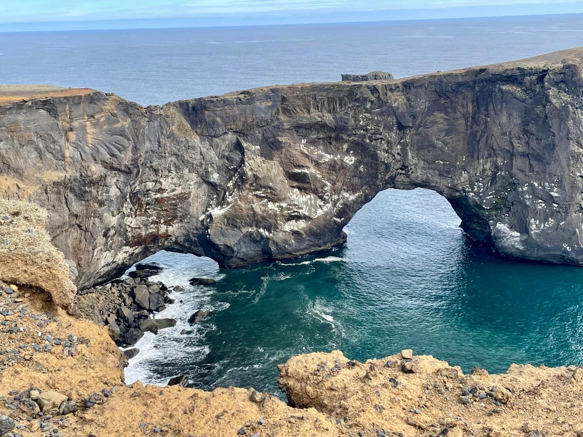
Dyrhólaey
Dyrhólaey is a small rocky peninsula and nature reserve on Iceland's South Coast, famous for its arch — large enough that small planes have famously flown throu…
について
Dyrhólaeyについて
Dyrhólaey is a small rocky peninsula and nature reserve on Iceland's South Coast, famous for its arch — large enough that small planes have famously flown through it — and as one of the best puffin-watching locations in Iceland.
One of the South Coast's strongest viewpoints, combining a monumental sea arch, nesting seabirds and panoramic black-sand coastline.
Dyrhólaey近くのツアー

South Coast Tour - Black Sand Beach, Plane wreck, Skogafoss, Seljalandsfoss guided in Chinese冰岛南岸黑沙滩飞机残骸中文一日团
Magic Iceland Travel · 10 hours 30 minutes
DT 322 Private Superjeep South Coast & Eyjafjallajökull Volcano Sights
Superjeep · 8 hours
South Coast Waterfalls, Glacier & Black Sand Beach Tour
BusTravel Iceland · 10 hours
South Coast Waterfalls, Black Beach and Glacier Adventure | Small Group Day Tour
Nicetravel · 11 hours
写真
ギャラリー
背景
歴史と背景
The name Dyrhólaey means 'Door Hill Island' referring to the massive sea arch cut through the volcanic rock promontory. The arch stands about 120 meters tall and was formed by wave erosion over millions of years. The site is a protected nature reserve and puffins nest in the cliffs from May to August each year. The lighthouse at the top of Dyrhólaey was built in 1910 and still operates today.
Dyrhólaey combines geology, birdlife and some of the widest coastal views in South Iceland. The headland was formed by volcanic activity beneath the sea or ice late in the glacial period, and waves later carved the huge arch that gives the place its name. From the upper and lower viewpoints, visitors can look west across long black-sand beaches, east toward Reynisfjara and Reynisdrangar, and inland toward Mýrdalsjökull. The area has been protected as a nature reserve since 1978. Bird nesting is taken seriously: parts of the reserve can close or operate with restricted hours during the spring nesting season, and the exact dates can change from year to year. The upper road is steep and can also close in winter because of ice or severe wind. Visitors should therefore follow the current signs at the entrance rather than rely on fixed historic closure dates.
民話
物語と民話
Dyrhólaey — 'The Hill that Has a Doorway' — is a volcanic headland southwest of Vík with a natural stone arch large enough to fly a small aircraft through, which Icelandic pilots famously used to do. The cliff is Iceland's southernmost point and hosts some of the country's largest puffin colonies in summer. The view from the lighthouse on top encompasses the entire South Coast — Reynisfjara beach, the Reynisdrangar sea stacks, Mýrdalsjökull glacier and on clear days, the Katla caldera beyond. The headland closes mid-May through mid-June during nesting season to protect the birds.
ご存知ですか?
Dyrhólaey has been protected as a nature reserve since 1978, and its name refers to the enormous 'door-hole' arch through the headland.
文化
物語と伝説
この地域のアイスランドのサガと民話
Dyrhólmar
Dyrhólmar is a historic location in Iceland mentioned in "Grettis saga", one of the ancient Íslendingasögur (Sagas of Icelanders). These medieval narratives preserve the history of Iceland's Viking Age settlement.
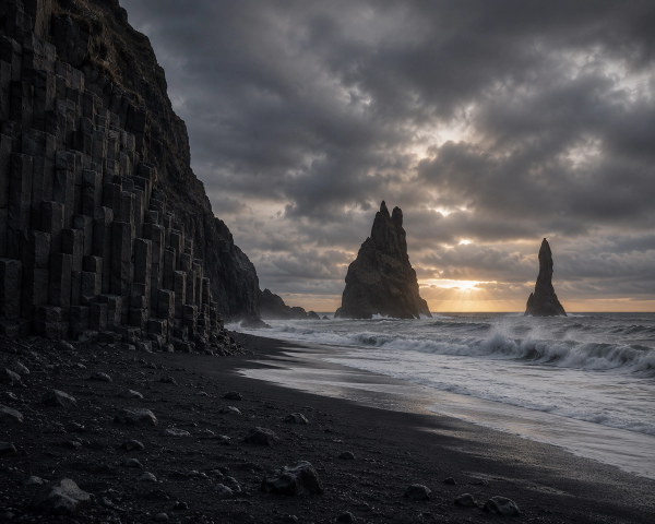
Reynisdrangar – Trolls Turned to Stone
The Reynisdrangar sea stacks off the coast of Iceland are said to be petrified trolls caught by the rising sun.
探索
近くの隠れた名所
Off-Peak Visit
Visit Dyrholaey during shoulder season (May or September) for a perfect balance of access and solitude.
You'll experience the site without summer crowds while still having good weather and daylight.
Local Flora
Look for the native Icelandic plants growing in the area — Arctic thyme, moss campion, and various lichens.
These resilient plants have adapted to survive harsh conditions and add subtle beauty to the landscape.
Changing Light
Dyrholaey looks dramatically different depending on the time of day and weather conditions.
Cloud shadows, rain showers, and low-angle sunlight can transform the landscape within minutes — Iceland's famous "four seasons in one day."
ヘルプ
よくある質問
場所
場所
Discover
Explore Nearby
Places from our database within 5.0 km — all data from Sanity
Loading nearby places…
0 places found within 5.0 km
Plan full itinerary →もっと探索