Reykjanesviti Lighthouse Trail
A short coastal walking area linking Reykjanesviti with the volcanic and geothermal landscape around Gunnuhver and Valahnúkamöl, with exposed terrain and Atlant…
At a Glance
Visit time
Allow 45–90 minutes for several short walks and viewpoints.
Best season
Calm, clear weather is best because the coast is very exposed to wind and surf.
Access
Use established parking areas near Reykjanesviti, Gunnuhver and Valahnúkamöl. Do not enter closed paths or approach cracks and cliff edges.
GPS
63.8150, -22.7015
About
About Reykjanesviti Lighthouse Trail
A short coastal walking area linking Reykjanesviti with the volcanic and geothermal landscape around Gunnuhver and Valahnúkamöl, with exposed terrain and Atlantic views.
Combine Iceland's oldest lighthouse tradition with geothermal steam and dramatic Atlantic coastal geology on short walks around one of Reykjanes' strongest sightseeing clusters.
Photos
Photo Gallery
Background
History & Background
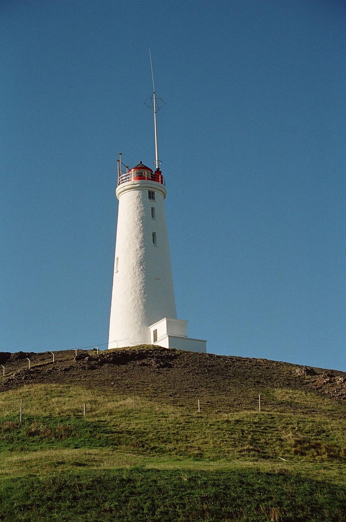
Iceland's first lighthouse was established in the Reykjanes area in 1878. The present Reykjanesviti tower was completed in 1908 after seismic activity affected the earlier lighthouse site. The surrounding walking area has developed around the lighthouse, geothermal sites and geosites of Reykjanes UNESCO Global Geopark rather than as one single historic trail.
The Reykjanesviti walking area combines several closely spaced attractions at the southwestern tip of the Reykjanes Peninsula. The lighthouse stands on a volcanic landscape near Gunnuhver, Valahnúkamöl and the eroded Valahnúkur headland, allowing visitors to explore maritime history, geothermal activity and Atlantic coastal geology in one compact area. Rather than a single officially defined long-distance trail, the experience consists of short walking connections and established paths around the lighthouse and neighbouring geosites. Reykjanes Geopark also describes a marked route from Gunnuhver toward Háleyjarbunga, while other paths lead to viewpoints over the coast. Safety conditions have become especially important in this area. Geological unrest has created cracks near Valahnúkur, and authorities have closed the path onto the headland. Visitors should stay on marked or established paths, remain well back from cliff edges and never cross barriers or warning signs. The Atlantic coast is extremely exposed, with strong winds and waves possible even when weather elsewhere on the peninsula seems calm. For most travellers, the best approach is to park at established visitor areas and make several short walks rather than trying to follow an invented continuous 'lighthouse trail'. Combine the area with Reykjanesviti, Gunnuhver and Valahnúkamöl, allowing time to stop safely between them.
Folklore
Story & Folklore
Reykjanesviti was built to help sailors navigate one of Iceland's most exposed coasts. Walking around the lighthouse today reveals why this location mattered: Atlantic waves strike a rapidly eroding volcanic shoreline, geothermal steam rises nearby and offshore landmarks such as Eldey break the horizon. The paths around the lighthouse are therefore less about one named trail and more about moving through a compact landscape of connected stories — navigation, volcanism, geothermal heat and coastal erosion. Recent cracks near Valahnúkur add another reminder that the ground itself continues to change.
💡 Did You Know?
The current Reykjanesviti lighthouse dates from 1908, replacing Iceland's first lighthouse from 1878 after seismic instability affected the original site.
Culture
Stories & Legends
Icelandic sagas and folklore from this area
Location
📍 Location
Discover
Explore Nearby
Places from our database within 1.0 km — all data from Sanity
Loading nearby places…
0 places found within 1.0 km
Plan full itinerary →Explore More