
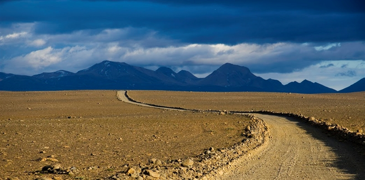
古老的 Kjalvegur 高地徒步路线
古老的 Kjalvegur(Kjalvegur hinn forni)是一条约 41 公里的历史高地徒步路线,连接 Hveravellir 与 Hvítárnes,位于 Langjökull 和 Hofsjökull 两大冰川之间。它不同于现代 Kjölur 公路,路线更靠近 Langjökull,穿越植被相对丰富的高…
概览
游览时间
2–3 days for the full trail, or shorter out-and-back sections from either end.
最佳季节:
Usually late June to early September, depending on road openings, snow and weather.
前往方式
The full route is a 41 km hike. Hveravellir and Hvítárnes can both be reached by suitable 4x4 vehicles; there is no scheduled bus service on Kjölur.
GPS
64.7176, -19.4625
关于
关于古老的 Kjalvegur 高地徒步路线
古老的 Kjalvegur(Kjalvegur hinn forni)是一条约 41 公里的历史高地徒步路线,连接 Hveravellir 与 Hvítárnes,位于 Langjökull 和 Hofsjökull 两大冰川之间。它不同于现代 Kjölur 公路,路线更靠近 Langjökull,穿越植被相对丰富的高地。Ferðafélag Íslands 在大部分路线设置了木桩和石堆标记,并运营沿途山屋。
Walk one of Iceland's classic historic Highland routes instead of merely driving the modern Kjölur road, with huts, glacial views and remote interior landscapes over 2–3 days.
古老的 Kjalvegur 高地徒步路线附近的旅游
照片
图库
背景
历史与背景
Kjalvegur was one of the established north–south travel corridors across Iceland's Highlands. Before roads for cars, the route used by riders lay farther west than the modern Kjölur road, closer to Langjökull and across more vegetated country. Ferðafélag Íslands has documented and maintained the old route as a hiking trail between Hveravellir and Hvítárnes.
Kjalvegur hinn forni is a multi-day hiking route across Kjölur rather than another name for the modern F35 road. It runs between Hveravellir and Hvítárnes, using the older travel corridor nearer Langjökull. The trail is generally straightforward in good summer weather and is marked for most of its length, but fog can reduce visibility to almost nothing and mobile coverage is unreliable. Hikers should carry navigation tools, waterproof and insulating layers, food, emergency equipment and suitable river-crossing footwear. Accommodation along the wider route is supported by the FÍ hut network.
民间故事
故事与民间故事
在机动车道穿越Kjölur之前,步行与骑马的旅人所走的路线更偏西,靠近Langjökull,那里的植被与水源使旅途更为便利。这条古老的路线如今以Kjalvegur hinn forni之名供徒步者行走。现代徒步路线连接Hveravellir与Hvítárnes,延续了缓慢穿越内陆高地的旅行体验,而非仅仅驾车横越。
你知道吗?
Kjalvegur hinn forni is 41 km long.
探索
附近的隐藏宝藏
Off-Peak Visit
Visit Kjalvegur during shoulder season (May or September) for a perfect balance of access and solitude.
You'll experience the site without summer crowds while still having good weather and daylight.
Local Flora
Look for the native Icelandic plants growing in the area — Arctic thyme, moss campion, and various lichens.
These resilient plants have adapted to survive harsh conditions and add subtle beauty to the landscape.
Changing Light
Kjalvegur looks dramatically different depending on the time of day and weather conditions.
Cloud shadows, rain showers, and low-angle sunlight can transform the landscape within minutes — Iceland's famous "four seasons in one day."
帮助
常见问题
位置
位置
Discover
Explore Nearby
Places from our database within 5.0 km — all data from Sanity
Loading nearby places…
0 places found within 5.0 km
Plan full itinerary →探索更多