
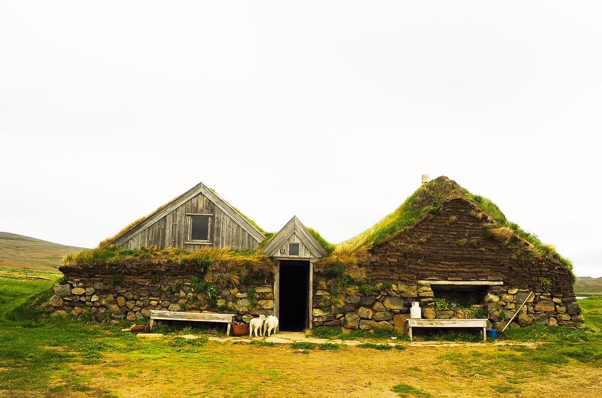
步行可达的高地农庄遗址
“Heiðarbýlin í göngufæri”是冰岛东部约库尔达尔斯黑兹及周边高地的文化徒步与历史遗产项目。沿线以信息柱和集章点串联昔日高地农庄遗址及居民故事,更适合作为一个完整的历史文化体验,而不是许多彼此分散的小型景点。
概览
游览时间
Half day to a full day if combining several sites; individual stops vary widely.
最佳季节:
Summer, in dry weather and good visibility
前往方式
Dispersed sites across Jökuldalsheiði and neighbouring heaths; there is no single trailhead. Use legal roads and tracks only, check conditions, and do not drive off-road.
关于
关于步行可达的高地农庄遗址
“Heiðarbýlin í göngufæri”是冰岛东部约库尔达尔斯黑兹及周边高地的文化徒步与历史遗产项目。沿线以信息柱和集章点串联昔日高地农庄遗址及居民故事,更适合作为一个完整的历史文化体验,而不是许多彼此分散的小型景点。
照片
图库
背景
历史与背景
Year-round settlement on Jökuldalsheiði resumed in 1841 and the 16 principal farms of the heath were established between 1841 and 1862. The broader Heiðarbýlin í göngufæri project later included additional sites on Vopnafjarðarheiði and in Almenningur in Selárdalur, bringing the project total to 26 farm sites. The 1875 Askja eruption deposited ash across the region and badly affected several farms. In later decades improved road connections changed trade patterns, while depopulation gradually ended permanent farming on the heaths. The project was developed to preserve and communicate the history of these farms through site information, guest books and stamps.
Heiðarbýlin í göngufæri is best understood as one broad cultural landscape rather than a collection of tiny standalone attractions. The project connects former farms on Jökuldalsheiði and surrounding heaths, where permanent settlement expanded during the 19th century. Many farms stood at around 500 metres above sea level or higher, and families relied on grazing, fishing, hunting and long journeys to trading centres. The wider project ultimately included 26 farm sites across Jökuldalsheiði, Vopnafjarðarheiði and Almenningur in Selárdalur. The landscape also records major changes in Icelandic history. Ash from the 1875 Askja eruption fell heavily over parts of the highlands, damaging land and contributing to the abandonment of several farms. Some residents later emigrated to North America. Other farms survived for decades longer, with a few remaining occupied into the 20th century. For visitors, the experience is dispersed. There is no single entrance or trailhead, and conditions vary greatly between sites. Some ruins lie near roads or tracks, while others require walking across exposed or fragile ground. Information posts associated with the Heiðarbýlin project tell the stories of the farms and their residents and have also been used for a stamp-based walking challenge. Visitors should choose a manageable group of sites, check road and weather conditions, avoid off-road driving, and respect wetlands, ruins and fragile vegetation. This parent attraction preserves the history of Hlíðarendi, Háreksstaðir, Kálffell, Lindarsel, Melur, Netsel, Rangalón, Víðihólar and Ármótasel while avoiding nine separate low-value attraction pages. Sænautasel remains a separate destination because it has its own established visitor experience.
民间故事
故事与民间故事
In the mid-19th century, families began building permanent farms high on Jökuldalsheiði, often more than 500 metres above sea level. Life there depended on grazing, trout fishing, birds and long journeys for trade. The settlement grew from 1841 onward, but the landscape could be unforgiving. Ash from the 1875 Askja eruption badly affected parts of the heaths, accelerating abandonment in some areas and contributing to migration from East Iceland. Yet several farms endured well into the 20th century. Today the remains are scattered across a broad, quiet landscape rather than gathered at one visitor site. The Heiðarbýlin í göngufæri project links these places through information posts, stories and a walking challenge. Visiting them is less about ticking off individual attractions and more about understanding how people adapted to isolation, weather, distance and environmental change in Iceland's high country.
探索更多