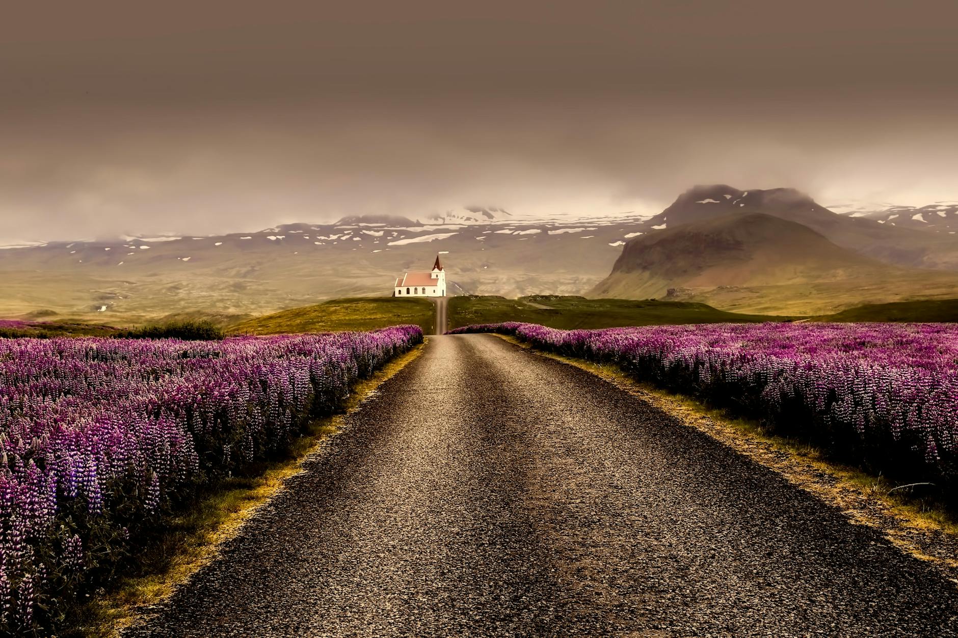
Hiking Trails in Iceland
Iceland offers some of the most diverse hiking landscapes in the world — from lava fields and waterfalls to glaciers, volcanic craters and remote highland valleys.
Explore 53+ hiking trails organized by region. Each trail includes difficulty level, walking time, elevation and nearby folklore.
Did you know? Iceland's mountains and lava fields are traditionally believed to be home to hidden people. Hikers were historically advised to avoid disturbing rock formations, as they were thought to be the homes of elves and nature spirits.
Hiking Trails in Iceland — Explore by Region, Difficulty and Landscape
Use this guide to plan your hiking adventure across Iceland. Whether you are looking for easy family-friendly walks near Reykjavík, scenic waterfall hikes on the South Coast, volcanic crater routes on the Reykjanes Peninsula or multi-day highland treks, every trail type is covered here.
- ✓ Easy family-friendly walks
- ✓ Scenic waterfall hikes
- ✓ Volcanic crater routes
- ✓ Geothermal valley trails
- ✓ Multi-day highland treks
- ✓ Hidden local favorites near Reykjavík
Hiking Trails in Capital Region
The Capital Region offers some of the most accessible hiking routes in Iceland — perfect for short adventures close to Reykjavík, suitable year-round.
📅 Most trails accessible year-round.

geopoint
Mount Esja Summit Trail
Popular Reykjavik hiking mountain offering panoramic views over the capital area.
👻 Mount Esja is named after a woman from early Icelandic settlement legends.

geopoint
Helgafell Hafnarfjordur Trail
Short scenic hike with panoramic lava field views.
👻 Hafnarfjordur is widely known as Iceland's elf capital.
geopoint
Ulfarsfell Summit Trail
Popular panoramic mountain hike near Reykjavik.
👻 Mountain said guarded by hidden beings.
Hiking Trails in Reykjanes Peninsula
Reykjanes is Iceland's youngest volcanic landscape and one of the most unique hiking areas near Keflavík Airport — lava deserts, geothermal steam and dramatic coastline.
📅 Volcanic activity may affect trail access.

geopoint
Gunnuhver Geothermal Trail
Boardwalk trail through steaming geothermal mud pools.
👻 Named after ghost Gunna who haunted the area after death.

geopoint
Fagradalsfjall Volcano Trail
Hike across recent lava fields from Iceland's newest eruptions.
👻 Fresh lava areas believed to awaken underground fire spirits.

geopoint
Reykjanesviti Lighthouse Trail
Coastal trail around Iceland's oldest lighthouse with lava fields and ocean cliffs.
👻 The Reykjanes area was believed to be guarded by sea spirits and lava trolls.

geopoint
Keilir Mountain Trail
Cone-shaped mountain hike with panoramic peninsula views.
👻 Believed to be a sleeping troll turned to stone.
Hiking Trails in West Iceland
West Iceland combines waterfalls, glaciers and lava formations within short driving distances. Ideal for day trips from Reykjavík.
📅 Great for day trips from Reykjavík.

geopoint
Glymur Waterfall Trail
Scenic canyon hike to Iceland's second highest waterfall featuring caves and river crossings.
👻 Legends say hidden people live inside the canyon walls.
Hiking Trails in Westfjords
The Westfjords offer some of Iceland's most remote hiking experiences with dramatic fjords and untouched Arctic wilderness.
📅 Best explored between June and August.

geopoint
Galtarviti Lighthouse Trail
Coastal trail to remote lighthouse views.
👻 Stories tell lighthouse protected sailors from spirits of storms.

geopoint
Bolafjall Trail
Panoramic cliff viewing platform trail.
👻 Lookout point of ancient giants.

geopoint
Hornstrandir Coastal Route
Remote wilderness hiking route in Hornstrandir Nature Reserve.
👻 Abandoned settlements believed haunted by spirits.

geopoint
Hrafnseyri Trail
Historic walking route near birthplace of Jon Sigurdsson.
👻 Area believed spiritually protected farmland.
geopoint
Thingeyri Sandafell Trail
Mountain ridge viewpoint hike above Thingeyri.
👻 Mountain believed once home of hidden warriors.
geopoint
Bolafjall Cliff Trail
Panoramic cliff-edge viewing platform trail.
👻 Cliffs were believed to be lookout points of ancient giants.
geopoint
Latrafjall Bird Cliffs Trail
Walk along Europe's largest bird cliffs.
👻 Cliffs believed guarded by seabird spirits guiding sailors.
geopoint
Valagil Gorge Trail
Hidden gorge trail with waterfalls and moss valleys.
👻 Believed home of hidden people settlements.

geopoint
Skrudur Botanical Walk
Short walk through Iceland's oldest botanical garden.
👻 Garden believed protected from harsh weather by guardian spirits.

geopoint
Dynjandi Trail
Trail to the most iconic waterfall of the Westfjords.
👻 Waterfall mist believed to hold protective spirits.
geopoint
Latrafjarg Cliff Trail
Walk along Europe's largest seabird cliffs.
👻 Cliffs believed guarded by seabird spirits.
geopoint
Hornstrandir Coastal Trail
Remote wilderness hiking route in Iceland's most isolated nature reserve.
👻 Area long believed inhabited by spirits protecting abandoned settlements.
Hiking Trails in North Iceland
North Iceland is home to volcanic craters, canyon systems and lava formations around Lake Mývatn — combining geology and folklore-rich landscapes.
📅 Year-round access except Highlands roads.

geopoint
Asbyrgi Canyon Trail
Horseshoe canyon hike surrounded by towering cliffs.
👻 Believed to be formed by Sleipnir, Odin's eight-legged horse.

geopoint
Krafla Lava Field Trail
Walk through steaming lava fields near Krafla volcano.
👻 Stories describe underground fire spirits living beneath the lava.
Hiking Trails in East Iceland
East Iceland features the country's quietest hiking routes and spectacular waterfall trails — the perfect region for peaceful nature hiking away from crowds.
📅 Accessible most of the year.
geopoint
Borgarfjordur Puffin Trail
Easy boardwalk trail to puffin nesting cliffs.
👻 Seabirds were believed to guide fishermen safely home.
geopoint
Vestdalsfossar Trail
Multi-waterfall hiking valley trail above Seydisfjordur.
👻 Stories say elves lived behind waterfalls here.
geopoint
Seydisfjordur Waterfall Loop
Trail above town passing multiple waterfalls.
👻 Locals believed spirits lived inside surrounding fjord cliffs.
geopoint
Storurd Trail
Trail through giant moss-covered boulders and hidden ponds.
👻 Considered hidden-people territory.

geopoint
Storurd Boulder Field Trail
Trail through giant moss-covered boulders and turquoise ponds.
👻 Area believed to be sacred hidden-people territory.
Hiking Trails in South Iceland
South Iceland contains some of Iceland's most iconic hiking locations along the Ring Road — from famous waterfalls to hidden canyon passes.
📅 Year-round hiking opportunities.

geopoint
Reykjadalur Hot River Hike
A popular geothermal hiking route leading to a natural hot river where visitors can bathe in warm water surrounded by mountains and steam vents.
👻 The Reykjadalur valley is believed to be home to hidden people according to local folklore.

geopoint
Hofskirkja Turf Church Trail
Short historic walk around Iceland's last turf church.
👻 Church believed protected by guardian spirits.

geopoint
Haifoss Trail
Short hike to one of Iceland's tallest waterfalls.
👻 Nearby cliffs were believed to be troll shelters.
Hiking Trails in Highlands
The Highlands contain Iceland's most epic multi-day trekking routes. Laugavegur alone attracts 75,000–100,000 hikers annually — Iceland's greatest SEO anchor trail.
📅 Accessible June–September only.

geopoint
Fjallabak Nature Reserve Trail
Remote highland trail through volcanic landscapes and rivers.
👻 Travelers believed ancient guardians protected the reserve.

geopoint
Askja Vikraborgir Trail
Trail across volcanic terrain near Askja caldera.
👻 Stories describe the crater as a gateway to underground worlds.

Viti Crater Askja Trail
Walk around the turquoise Viti crater lake.
👻 Name means Hell, referring to steaming geothermal activity.

geopoint
Hveradalir Kerlingarfjoll Trail
Trail through colorful geothermal valleys in Kerlingarfjoll.
👻 Mountains are said to be petrified trolls.
geopoint
Blahnukur Summit Trail
Colorful rhyolite mountain hike with sweeping highland views.
👻 Locals believed the mountains were shaped by sleeping giants.
geopoint
Brennisteinsalda Trail
Sulfur-colored mountain trail through geothermal valleys.
👻 Steam vents were once thought to be entrances to hidden elf worlds.
geopoint
Laugahraun Lava Trail
Short lava field hike near Landmannalaugar hot spring area.
👻 Believed to be protected by hidden lava spirits.
Hiking Trails in Golden Circle

geopoint
Oxararfoss Trail
Short walk to scenic waterfall inside Thingvellir National Park.
👻 Waterfall believed to hide entrances to elf dwellings.

geopoint
Secret Lagoon Surroundings Walk
Short geothermal area walk near historic bathing site.
👻 Steam vents believed entrances to hidden elf tunnels.
Hiking Trails in Highlands Edge

geopoint
Gjain Valley Trail
Fairytale-like valley with waterfalls and lava formations.
👻 Considered a hidden elves' gathering place.
Hiking Trails in Reykjavik
geopoint
Ellidaardalur Valley Trail
Green river valley trail inside Reykjavik.
👻 River believed home to protective spirits.

geopoint
Perlan Forest Trail
Urban forest trail with city viewpoints.
👻 Hill believed home of hidden elves beneath lava.
Hiking Trails in Snæfellsnes

geopoint
Arnarstapi to Hellnar Coastal Trail
Coastal lava cliff walk between Arnarstapi and Hellnar with arches, seabirds and ocean views.
👻 The cliffs were believed to be guarded by Bárður Snæfellsás, the half-troll protector spirit of Snæfellsnes.

geopoint
Saxhóll Crater Trail
Short staircase climb to the top of a volcanic crater with panoramic lava field views.
👻 Locals believed elves lived within the lava formations surrounding the crater.

geopoint
Djupalonssandur Lava Trail
Trail through lava formations leading to a dramatic black pebble beach.
👻 Fishermen once lifted strength stones here to prove seaworthiness.
Hiking Trails in South Coast

geopoint
Reynisfjara Cliff Walk
Black sand beach cliffs and basalt columns walk.
👻 Sea stacks said to be trolls frozen in sunrise.

geopoint
Dyrholaey Peninsula Trail
Cliff walk with puffins and coastal arches.
👻 Arch believed gateway used by sea spirits.

geopoint
Kvernufoss Hidden Trail
Hidden waterfall trail behind Skogar museum area.
👻 Believed protected by mountain spirits.
geopoint
Thakgil Canyon Trail
Canyon hike surrounded by mossy cliffs.
👻 Caves believed homes of hidden people.
geopoint
Seljavallalaug Trail
Walk to one of Iceland's oldest swimming pools hidden in a mountain valley.
👻 Locals believed warm waters protected travelers from mountain spirits.

geopoint
Skogafoss Upper Trail
Trail above Skogafoss following waterfalls along Skoga river.
👻 Legend says Viking treasure lies hidden behind the waterfall.
Hiking Trails in Vatnajokull National Park
geopoint
Kristinartindar Summit Trail
Summit hike with glacier and coastal views.
👻 Peak believed lookout of ancient mountain guardians.

geopoint
Skaftafell Svartifoss Trail
Trail to basalt-column waterfall inside national park.
👻 Columns believed frozen remains of trolls.
Choose a Hiking Trail by Difficulty Level
Whether you are a first-time visitor or an experienced trekker, Iceland has hiking trails for every fitness level.
Easy Trails
- •Seljavallalaug
- •Reykjadalur hot river
- •Dimmuborgir lava fields loop
- •Ásbyrgi canyon floor
- •Elliðaárdalur Valley
- •Arnarstapi to Hellnar
Moderate Trails
- •Glymur waterfall
- •Hverfjall crater rim
- •Hengifoss waterfall
- •Bláhnjúkur (Landmannalaugar)
- •Mount Esja
- •Keilir summit
Challenging Trails
- •Fimmvörðuháls pass
- •Stórurð boulder valley
- •Hornstrandir coastal routes
- •Kerlingarfjöll traverse
- •Snæfellsjökull summit approach
Expert Trails
- •Laugavegur multi-day trek
- •Askja crater route
- •Drangey island routes
- •Landmannalaugar to Þórsmörk full traverse
Iceland Hiking Trails Map
Explore hiking trails across Iceland on our interactive map. Click any marker to see trail details — difficulty, distance, duration and nearby folklore.
Loading trail map…
Explore More of Iceland
GetYourGuide 🥾
Book a Guided Hiking Tour
Explore Iceland's most spectacular trails with expert local guides. Day hikes, multi-day treks and private tours available.
🌌 See the Northern Lights
Track real-time aurora activity and plan your Northern Lights trip with AuroraVision.
🎡 Tours & Experiences
Book Activities in Iceland
Tours & Activities
Book top-rated Iceland tours, day trips, and experiences — Northern Lights, glacier hikes, whale watching and more.
Browse Activities →Reykjavík City Pass
Unlimited access to top Reykjavík attractions, museums, and tours with one pass. Save up to 50% vs paying separately.
Get City Pass →🧭 Guided Experiences
Tours & Day Trips in Iceland
Golden Circle, Northern Lights hunts, whale watching, glacier hikes, lava cave tours and more. Book with free cancellation — confirmed instantly.