
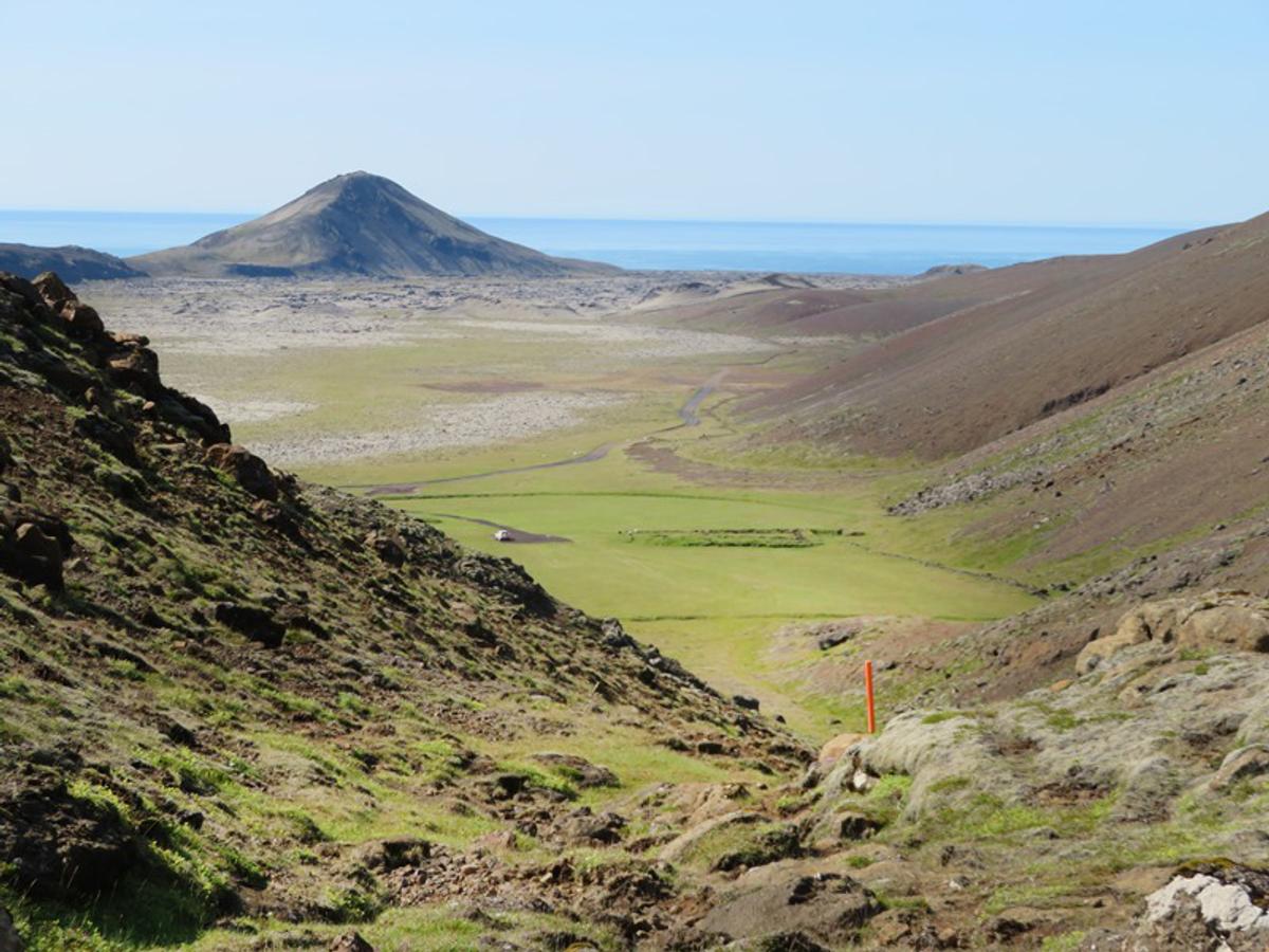
Vigdísarvellir
A remote Krýsuvík-area valley with the ruins of the old farms Bali and Vigdísarvellir, walking routes and a campsite reached by seasonal Road 428.
De un vistazo
Tiempo de visita
Allow at least 1–3 hours if combining the ruins with a walk.
Mejor temporada
Summer after seasonal road access has opened and conditions are dry.
Cómo llegar
Use Road 428 and check road conditions before travel. The road is closed in winter.
GPS
63.8871, -22.1208
Acerca de
Sobre Vigdísarvellir
A remote Krýsuvík-area valley with the ruins of the old farms Bali and Vigdísarvellir, walking routes and a campsite reached by seasonal Road 428.
Tours cerca de Vigdísarvellir

South Coast Tour - Black Sand Beach, Plane wreck, Skogafoss, Seljalandsfoss guided in Chinese冰岛南岸黑沙滩飞机残骸中文一日团
Magic Iceland Travel · 10 hours 30 minutes
DT 322 Private Superjeep South Coast & Eyjafjallajökull Volcano Sights
Superjeep · 8 hours
South Coast Small Group Tour: Waterfalls, Glacier & Black Sand Beach
BusTravel Iceland · 10 hours
South Coast Waterfalls, Black Beach and Glacier Adventure | Small Group Day Tour
Nicetravel · 11 hours
Visita Vigdísarvellir en coche
¿Vas a conducir hasta aquí? Compara vehículos adecuados para la región y consulta ofertas para tus fechas.
Busca disponibilidad real aquí
Los tipos de coche son sugerencias, no precios ni disponibilidad en tiempo real. GoIceTravel puede recibir una comisión sin coste adicional.
Fotos
Galería
Antecedentes
Historia y Antecedentes
The Vigdísarvellir area contains the ruins of the old farms Bali and Vigdísarvellir. The area later became a recreational and camping destination with access to multiple hiking routes in the Krýsuvík interior. Road 428 is seasonal and closed in winter.
Vigdísarvellir lies in the interior of the Reykjanes Peninsula within the broader Krýsuvík landscape. Today it is valued for quiet outdoor recreation, but the area also preserves the remains of earlier settlement. Visit Reykjanes specifically identifies the ruins of the old farms Bali and Vigdísarvellir, giving the site a cultural layer that is easy to miss if it is described only as a hiking trail. The surrounding landscape consists of low volcanic mountains, old lava and open valleys, with numerous possible walks toward areas such as Djúpavatn, Sogin and the Krýsuvík highlands. A campsite has also operated at Vigdísarvellir, making it a traditional base for people exploring this less-developed part of the peninsula. Access is a major practical consideration. Vigdísarvellir is reached by Road 428, and Visit Reykjanes states explicitly that the road is closed during winter. Road conditions can also vary outside the formal closure period, so travellers should check current road information before setting out and should not assume that an ordinary sightseeing car can always reach the area comfortably. At the ruins, visitors should avoid disturbing stonework or archaeological remains. The appeal of Vigdísarvellir is the combination of abandoned settlement, open landscape and access to a network of quieter walks rather than one headline attraction.
Folclore
Historia y Folclore
Vigdísarvellir shows how quickly a lived-in place can return to open landscape. Farms once stood here in the interior of Reykjanes, including Bali and Vigdísarvellir, but today their ruins sit among hills, lava and walking routes. Modern visitors arrive for camping and hiking, often experiencing the area as wilderness. The surviving farm remains are a reminder that the same valleys were once part of a working human landscape. That contrast — abandoned settlement and renewed outdoor recreation — is what gives Vigdísarvellir its character.
Ubicación
Ubicación
Descubre
Explora los alrededores
Lugares a menos de 5.0 km
Cargando lugares cercanos…
0 lugares encontrados a menos de 5.0 km
Planificar el itinerario completo →Explorar más