Krýsuvík - Grænavatn - Austurengjar - gönguleið
A roughly 3 km walk through the Krýsuvík landscape linking Grænavatn with Austurengjar, combining explosion craters, geothermal ground and traces of the old far…
At a Glance
Visit time
About 1.5–2 hours for the roughly 3 km route.
Best season
Dry, calm conditions with good visibility.
Access
Start around the Grænavatn/Krýsuvík area and use established local routes toward Austurengjar. Avoid geothermal crust and unmarked steaming ground.
GPS
63.8845, -22.0556
About
About Krýsuvík - Grænavatn - Austurengjar - gönguleið
A roughly 3 km walk through the Krýsuvík landscape linking Grænavatn with Austurengjar, combining explosion craters, geothermal ground and traces of the old farming district.
Combine a dramatic crater lake, active geothermal terrain and Krýsuvík's cultural landscape on a short but varied Reykjanes walk.
Photos
Photo Gallery
Background
History & Background
Krýsuvík was historically a parish and large farming estate with several tenant farms. The district later became best known for its geothermal and volcanic features. Grænavatn, Austurengjar and nearby Seltún now form part of the recreational and geological landscape of Reykjanes.
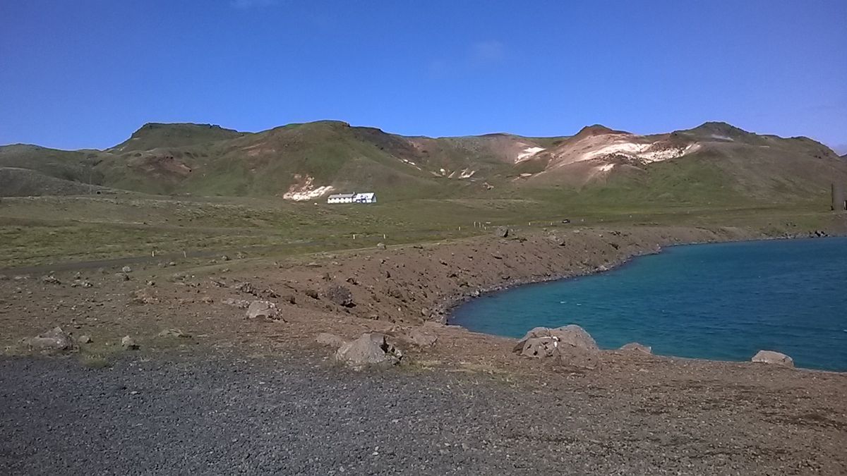
The Krýsuvík – Grænavatn – Austurengjar walk links several different parts of the Krýsuvík landscape south of Kleifarvatn. Grænavatn is a maar-type explosion crater filled by a striking green lake. Visit Reykjanes describes it as the largest of the explosion-crater lakes in the area and around 46 metres deep. From there the route continues through open volcanic terrain toward Austurengjar, one of the principal geothermal areas of Krýsuvík. The wider district adds cultural history to the geology. Krýsuvík was once a separate parish and a substantial farming estate with tenant farms. Remains of old buildings survive in the landscape, while geothermal fields such as Seltún, Austurengjar and Hverahlíð show the active volcanic processes below ground. Existing local route information describes this particular walk as approximately 3 kilometres and around 1.5–2 hours. It is not a manicured urban path. Weather can be exposed, surfaces may be rough or wet and geothermal ground requires caution. Stay away from mud pools, steam vents and discoloured crust unless a clearly established path leads through the area. The route is especially useful for visitors who want more than the short boardwalk experience at Seltún and are prepared for a quieter walk through the broader Krýsuvík landscape.
Folklore
Story & Folklore
A walk from Grænavatn toward Austurengjar passes through several stages of Reykjanes geology in a short distance. Grænavatn occupies an explosion crater, created when rising magma interacted violently with groundwater. Farther across the landscape, Austurengjar reveals heat that is still active below the surface through steam and geothermal mud. Between these geological features are traces of Krýsuvík's human history. The district once supported farms and a parish, reminding walkers that this seemingly harsh volcanic environment was also worked and travelled for generations.
💡 Did You Know?
Grænavatn is a lake-filled explosion crater about 46 metres deep, while Austurengjar is one of the main geothermal areas of Krýsuvík.
Location
📍 Location
Discover
Explore Nearby
Places from our database within 1.0 km — all data from Sanity
Loading nearby places…
0 places found within 1.0 km
Plan full itinerary →Explore More