Explorar IslandiaAtraccionesBuild TripPronóstico de auroras en vivo

Language

Iceland Highlands — Landmannalaugar rhyolite mountains
Ultimate Guide · Updated 2026

Iceland Highlands

The ultimate guide to Iceland's remote interior — F-roads, volcanic landscapes, geothermal hot springs, hiking trails and how to plan your trip.

1/3
of Iceland's total area
Jun – Sep
Accessible season
400–1,100 m
Altitude
0
Petrol stations inside
F35
Easiest access route

What Are the Iceland Highlands?

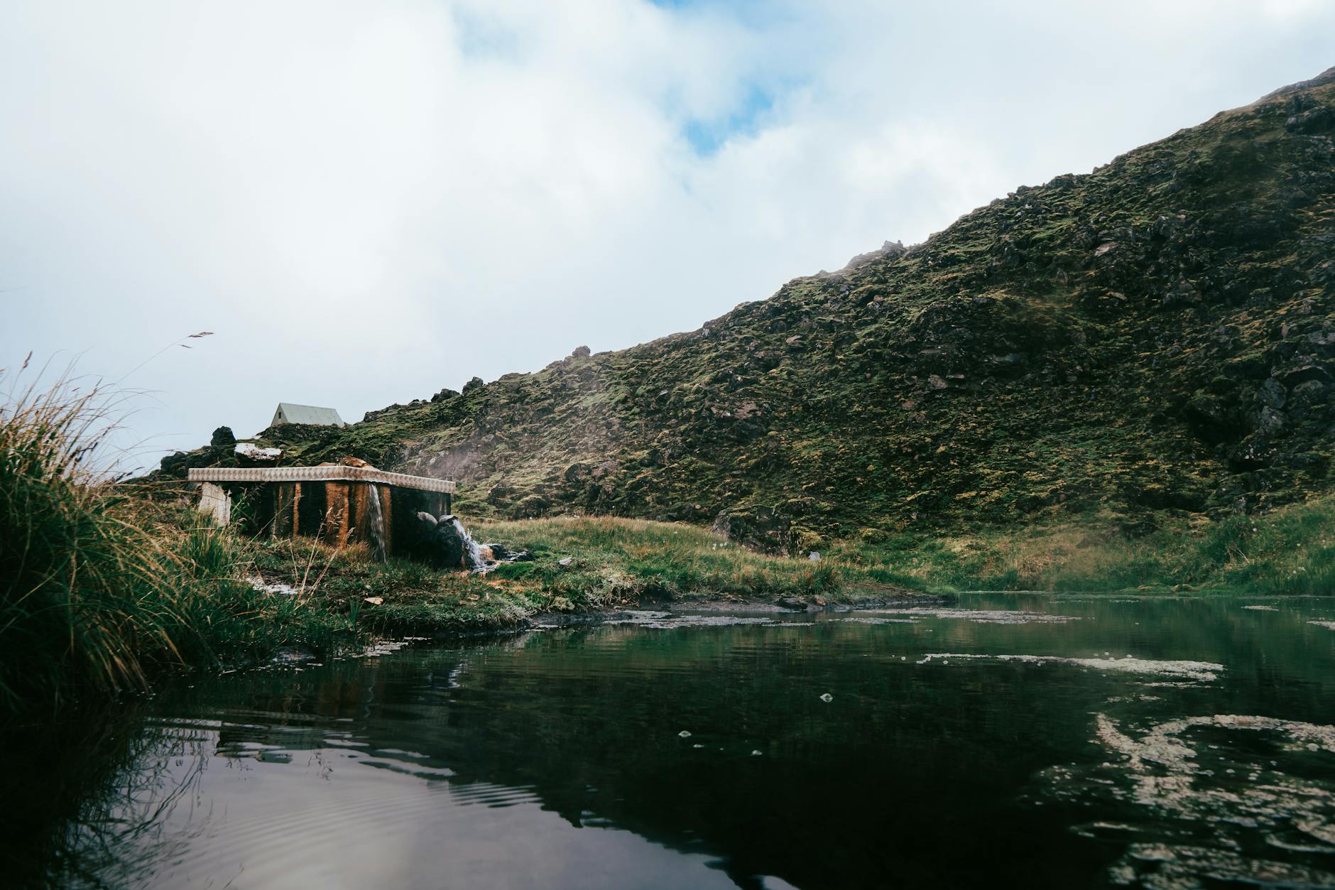
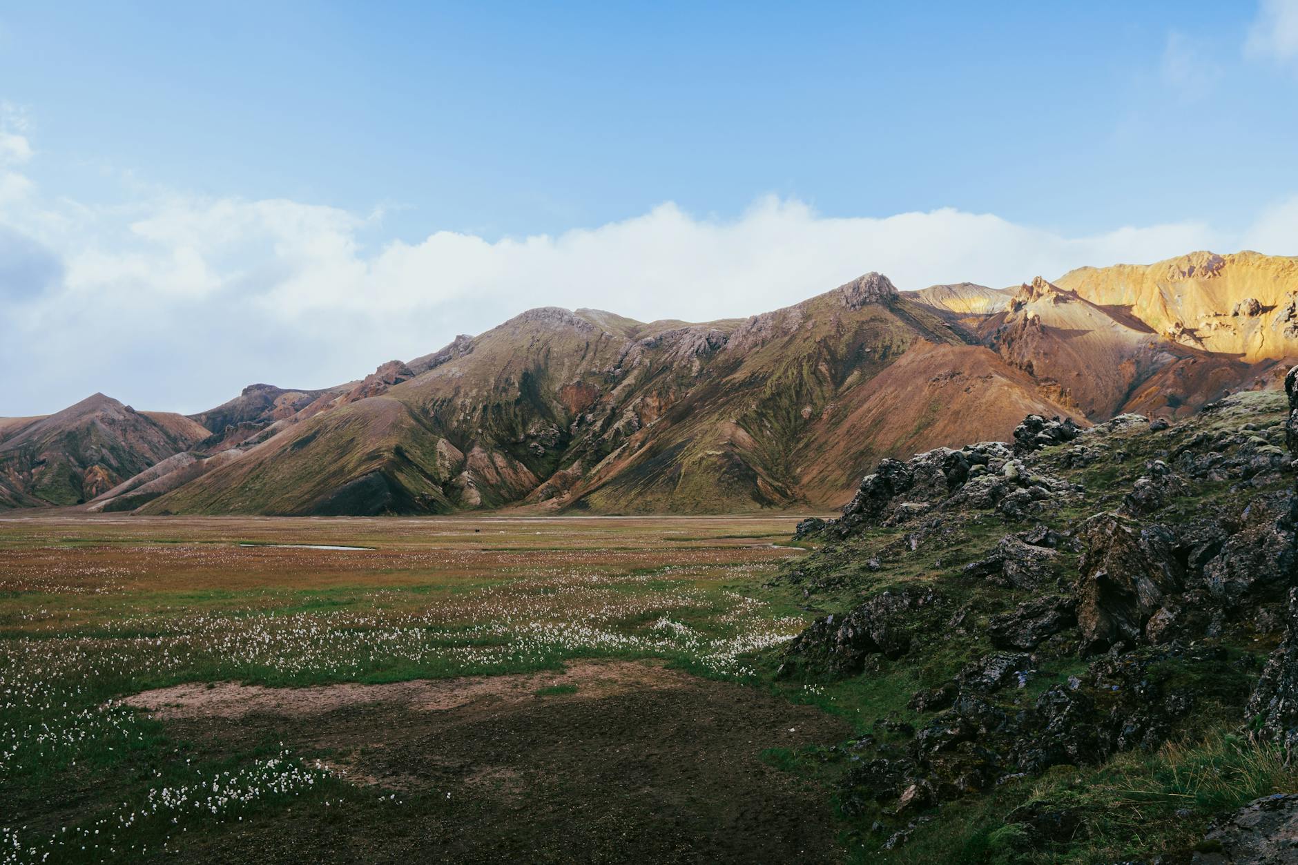
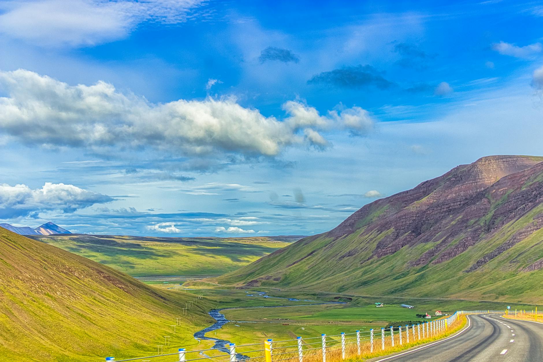
The Highlands — Miðhálendi Íslands — are Iceland's vast interior plateau, covering roughly one-third of the country. Sitting at 400–1,100 metres above sea level, this is one of Europe's last true wildernesses: no towns, no permanent inhabitants, and roads that are impassable for most of the year.

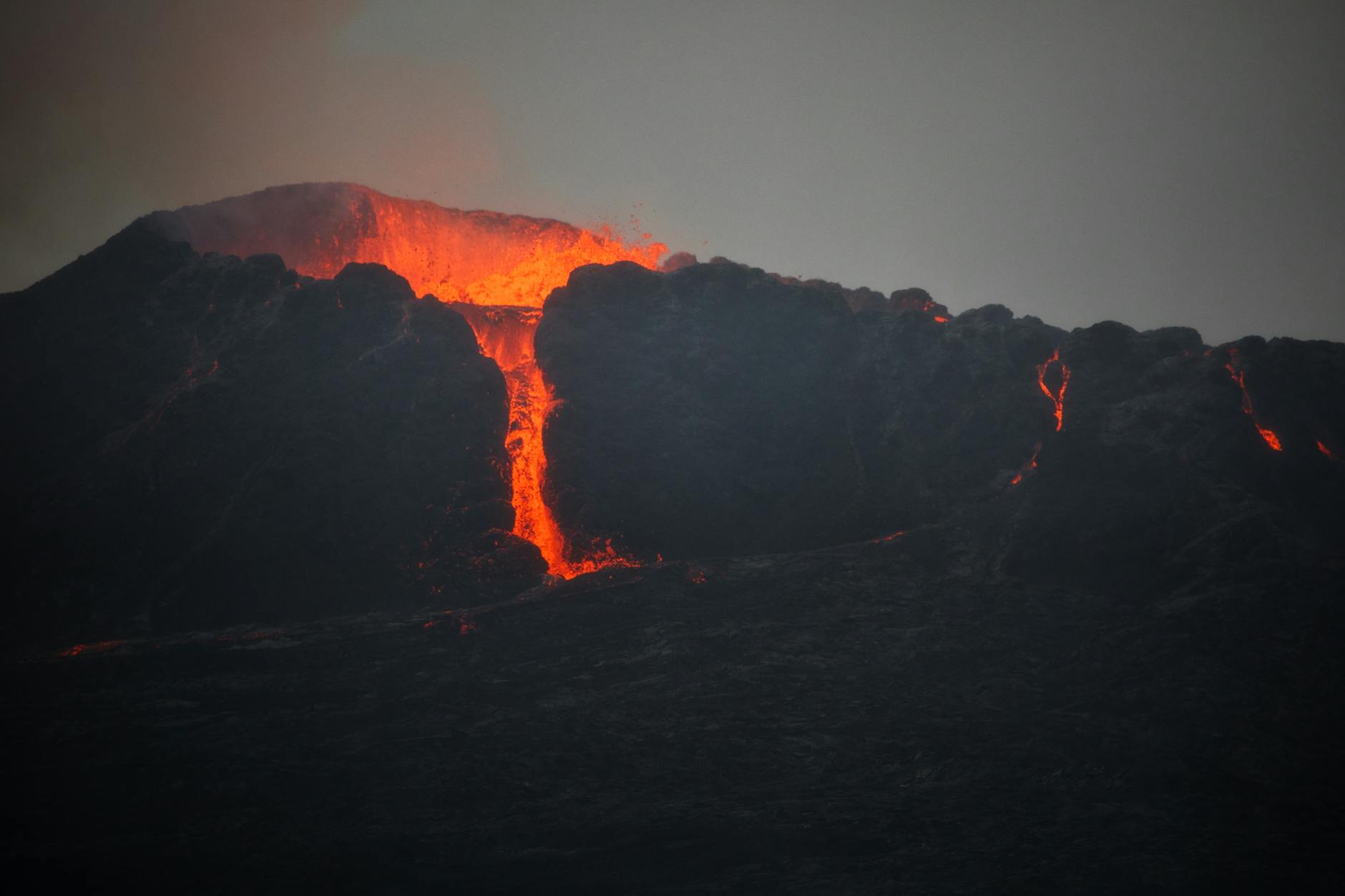
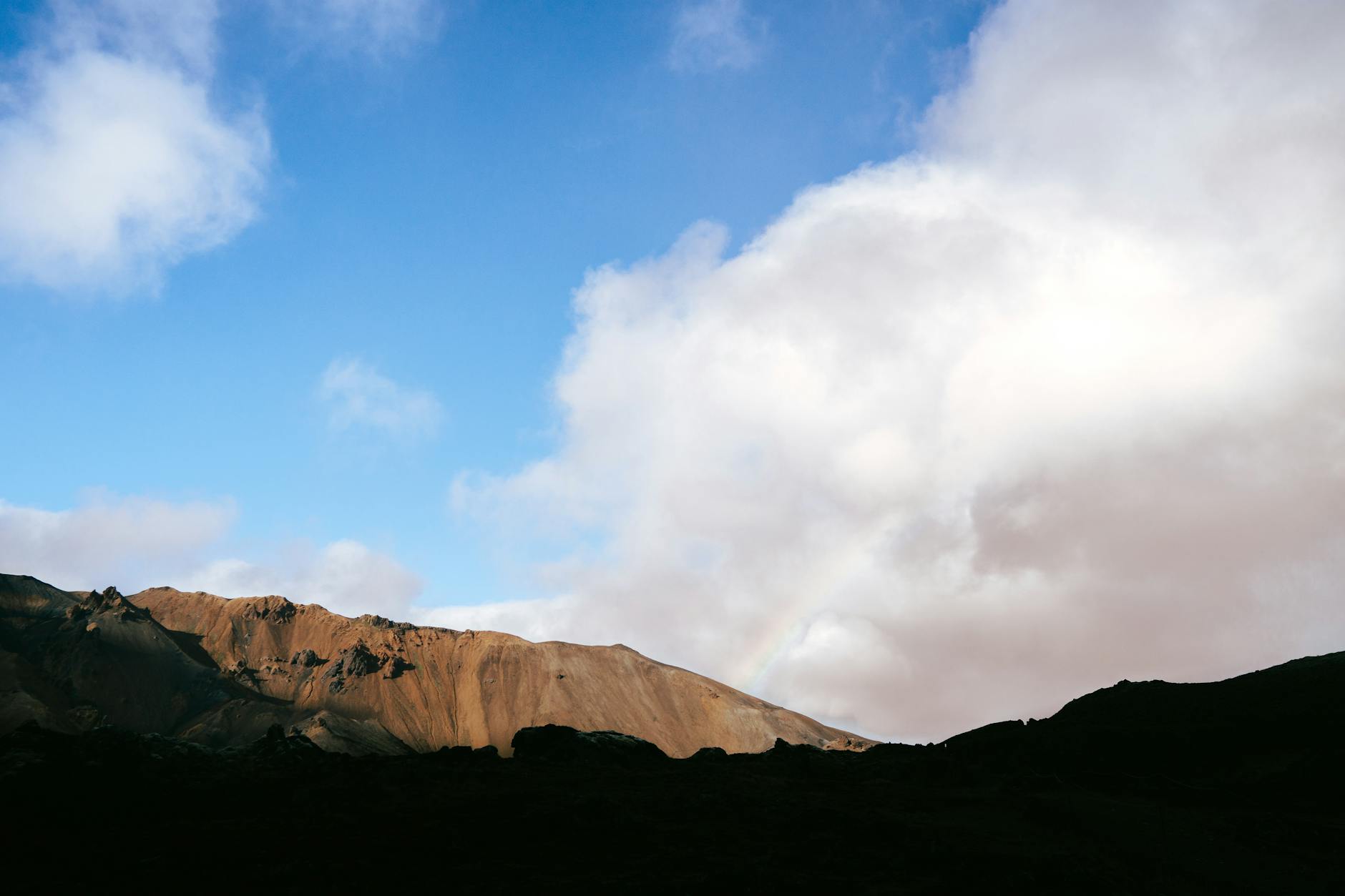
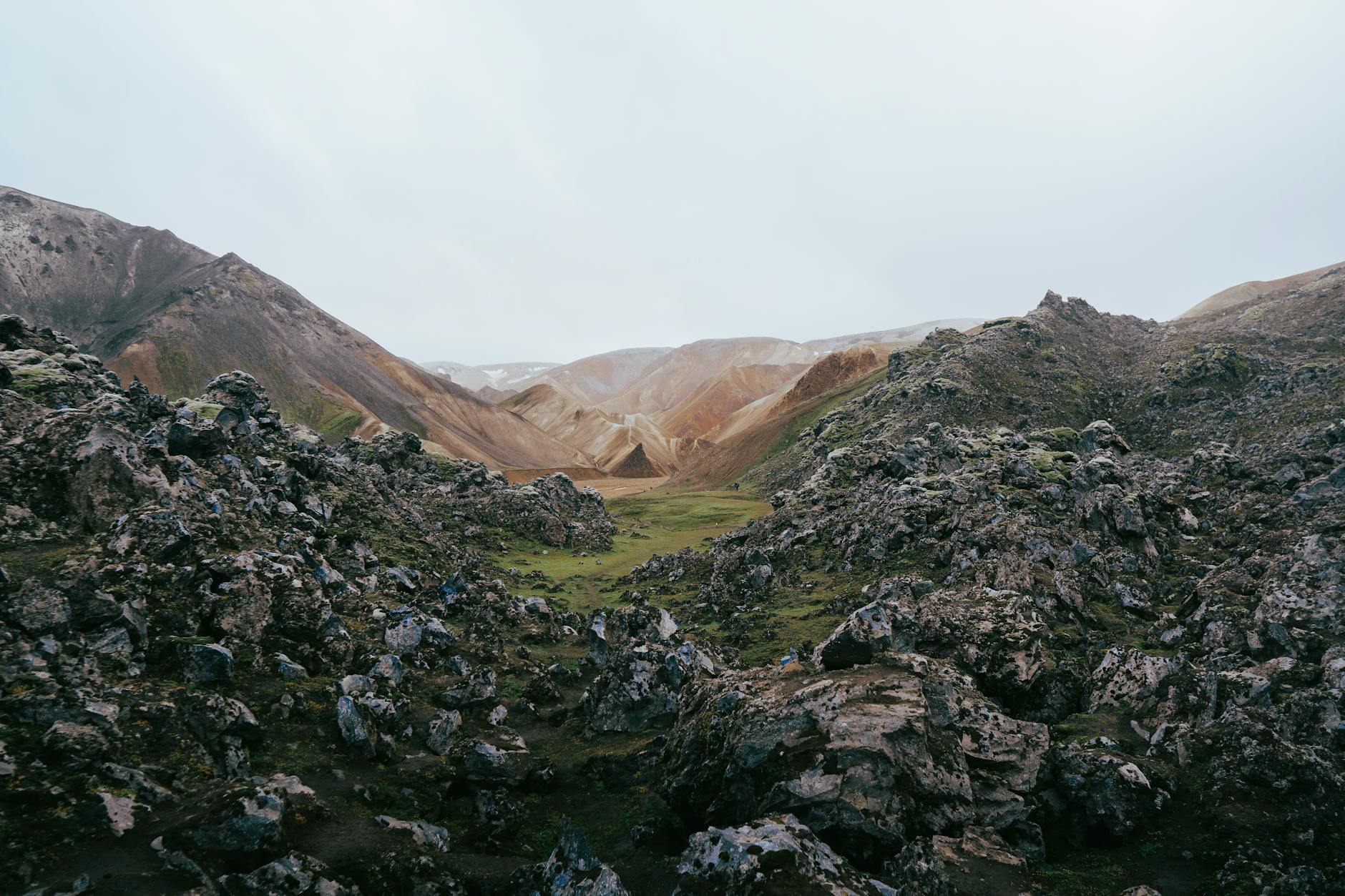
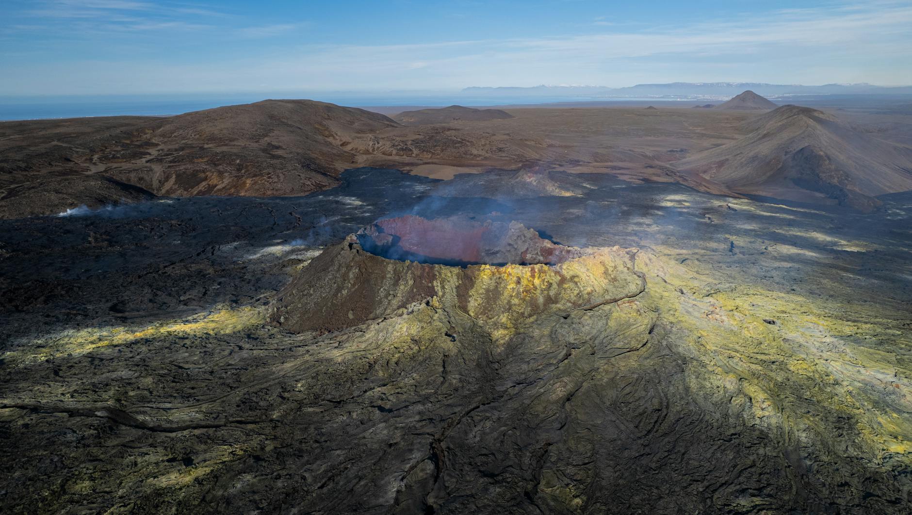
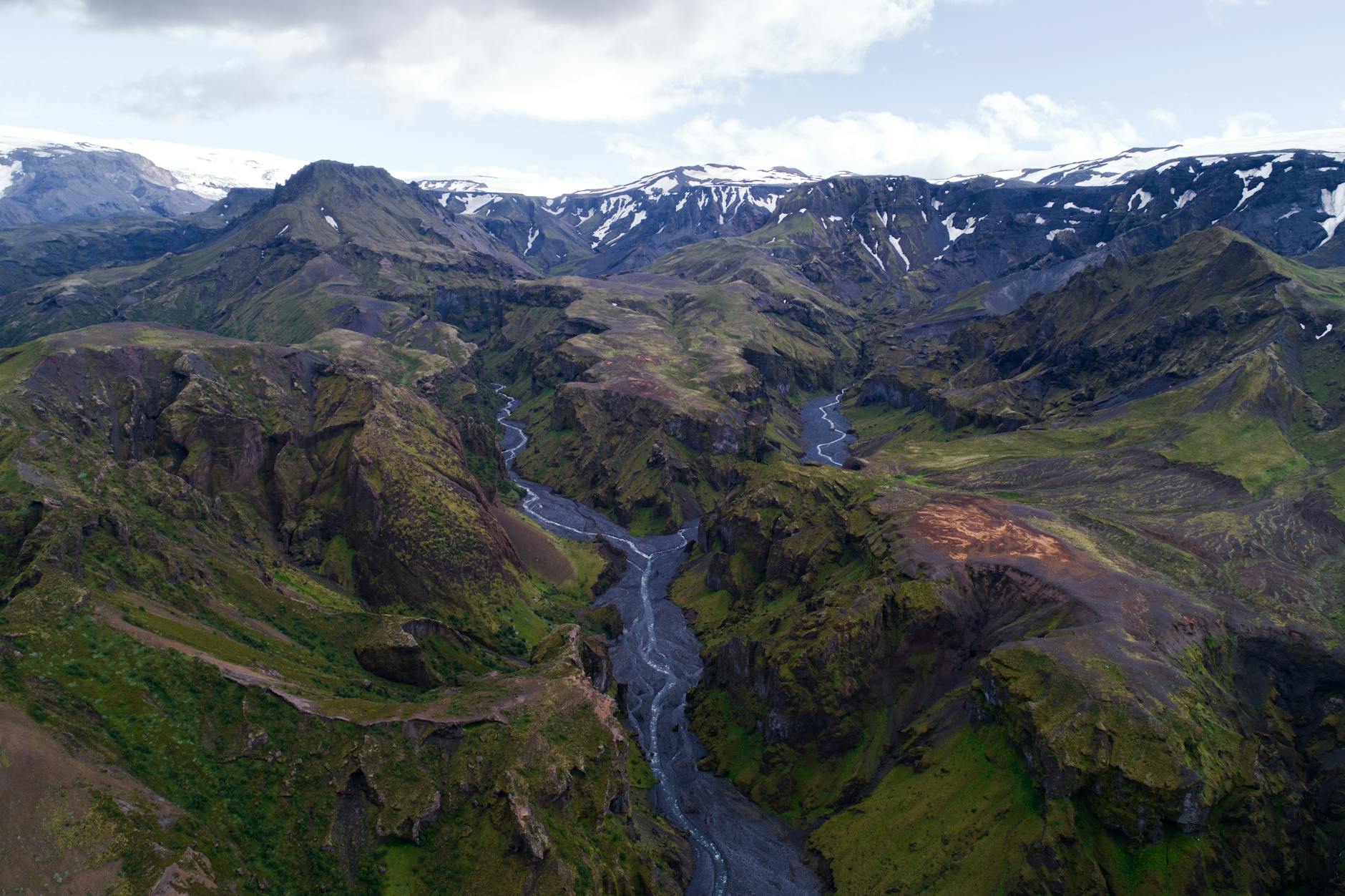
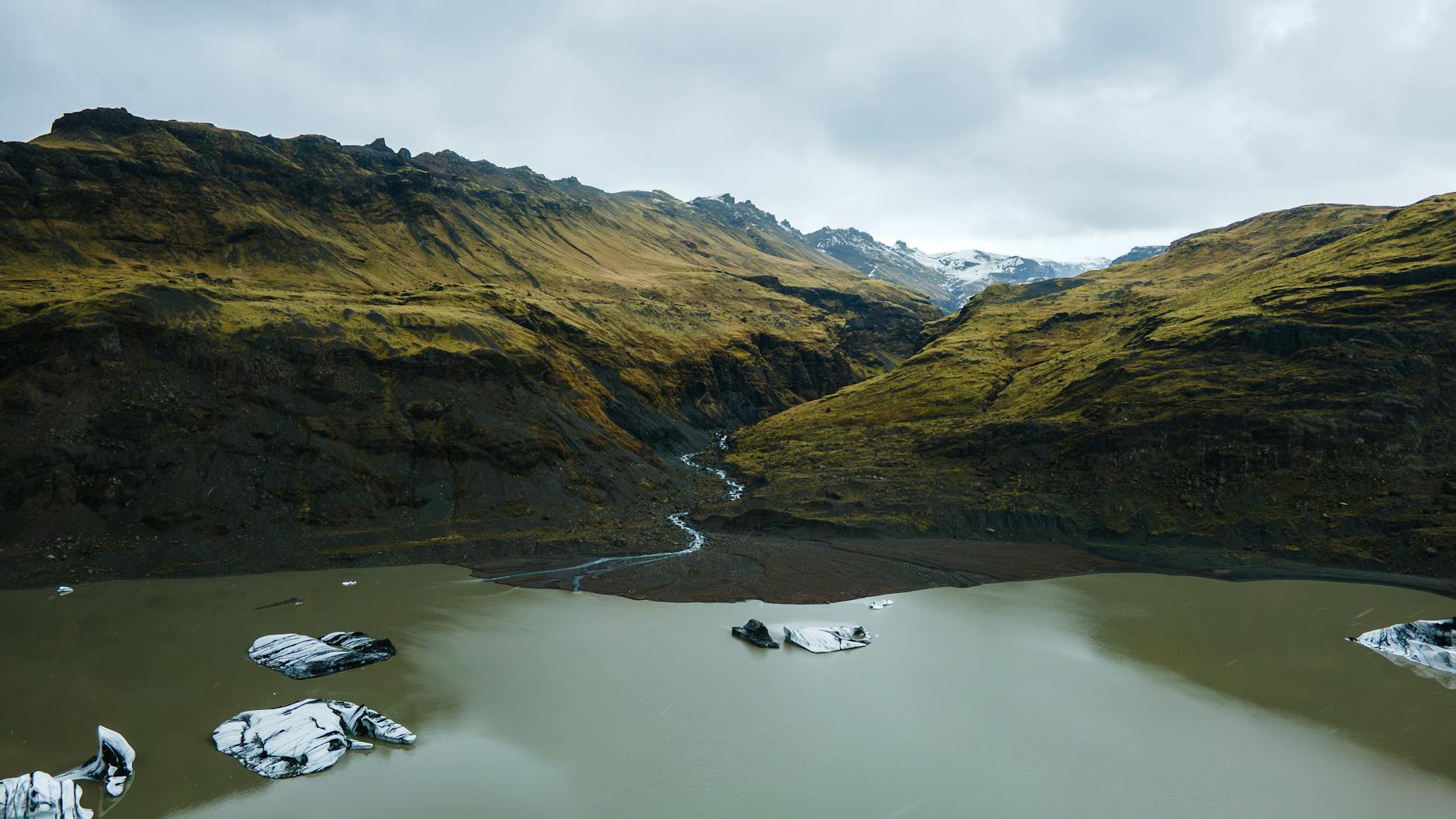
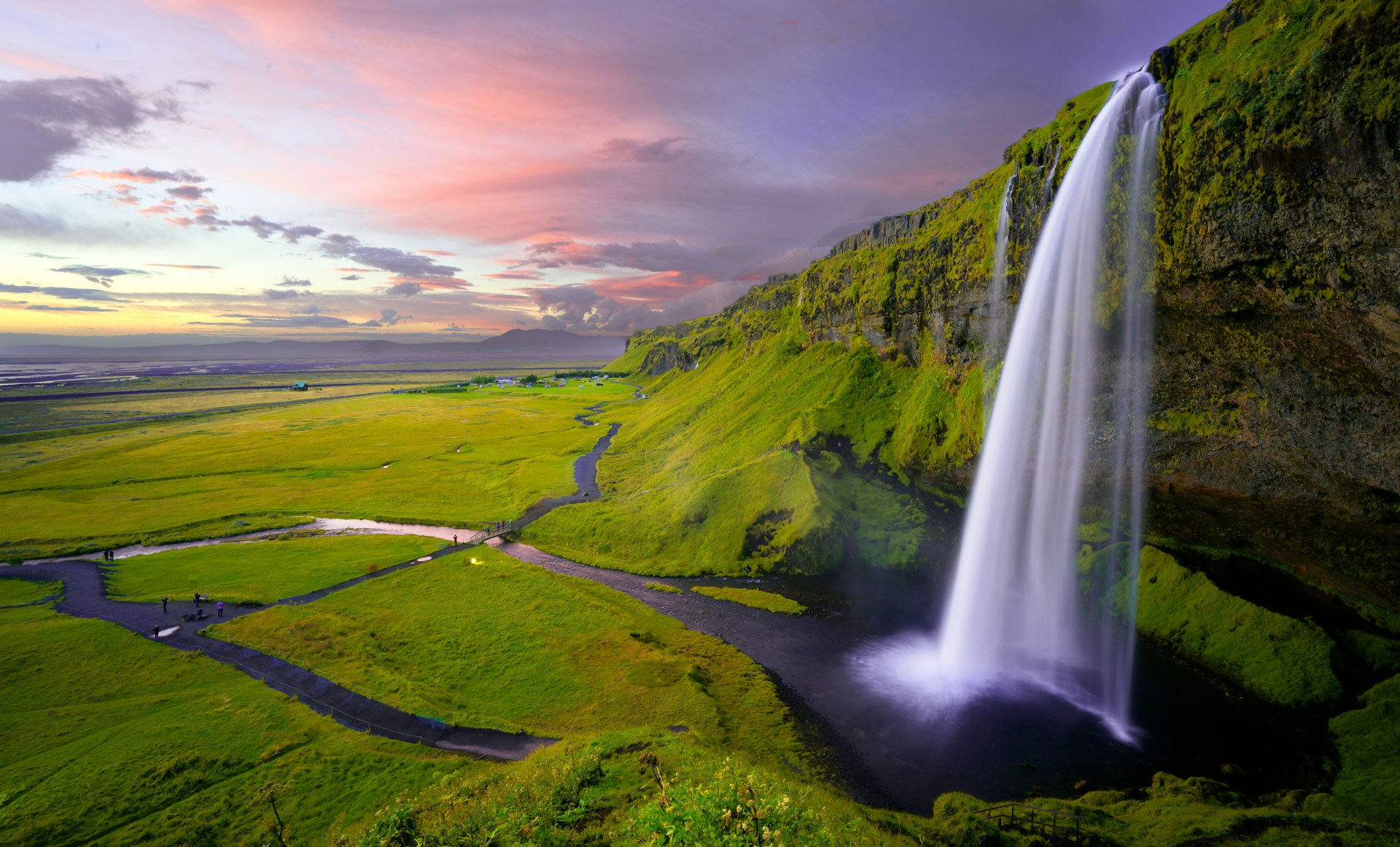
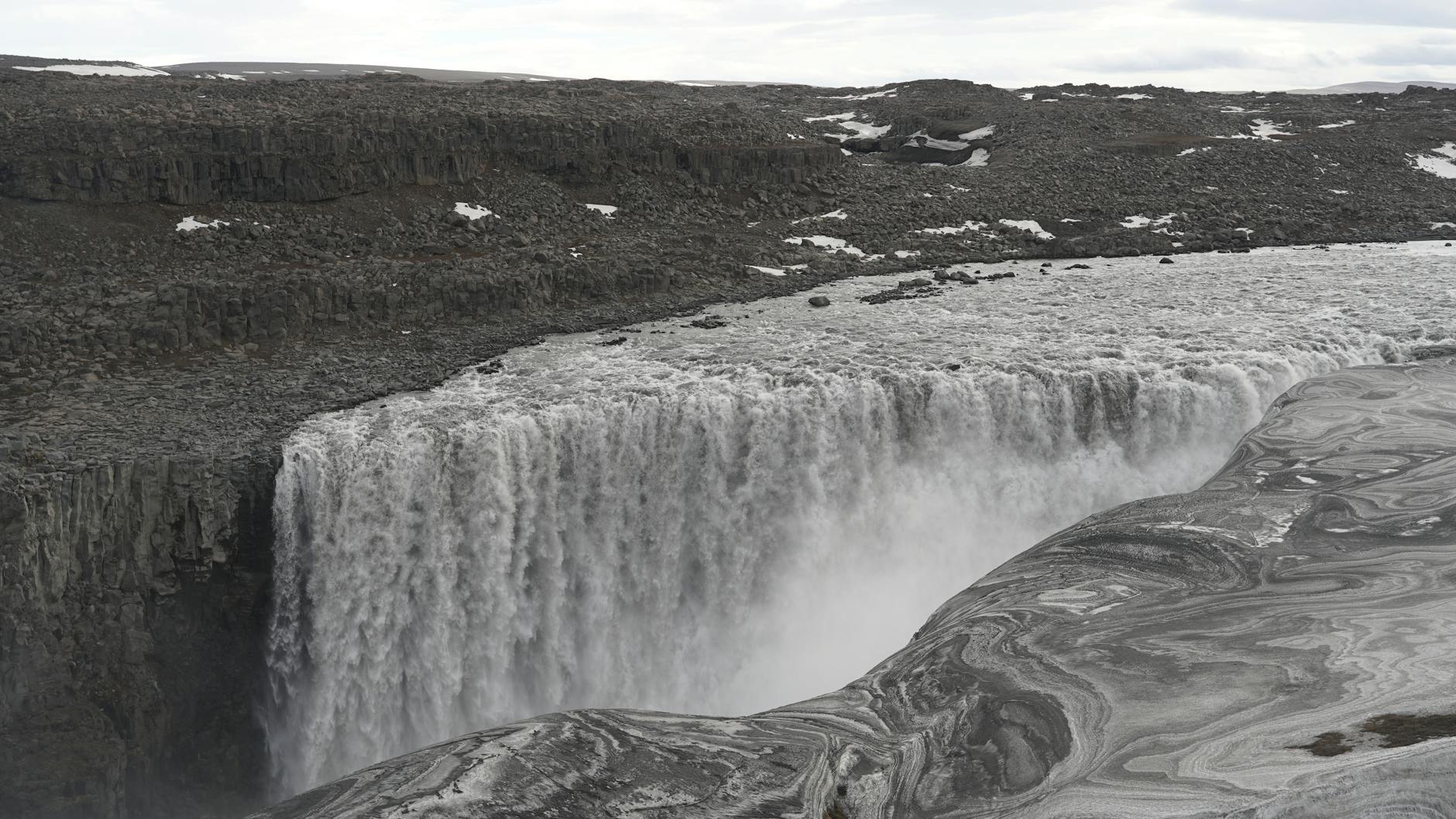
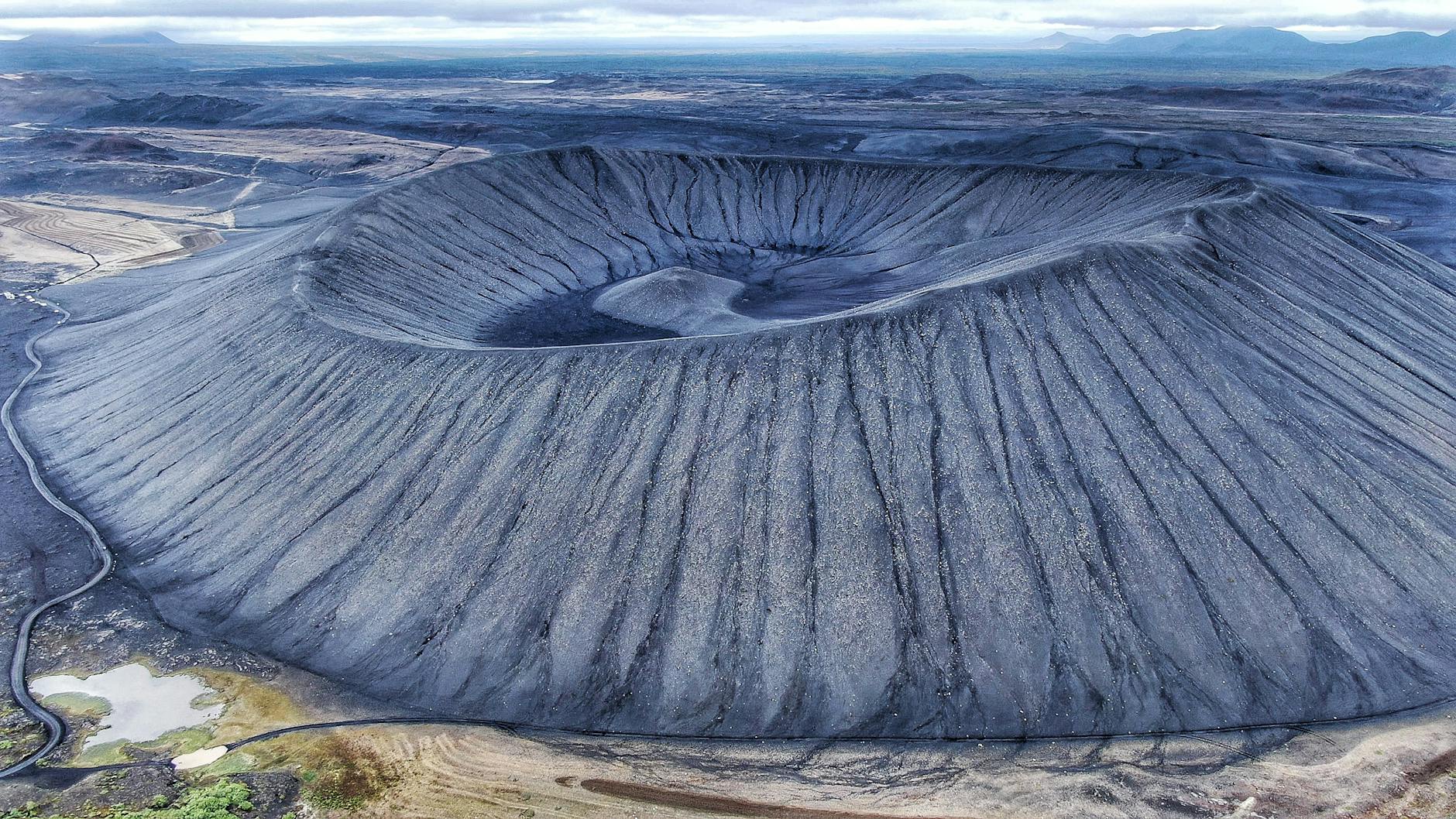
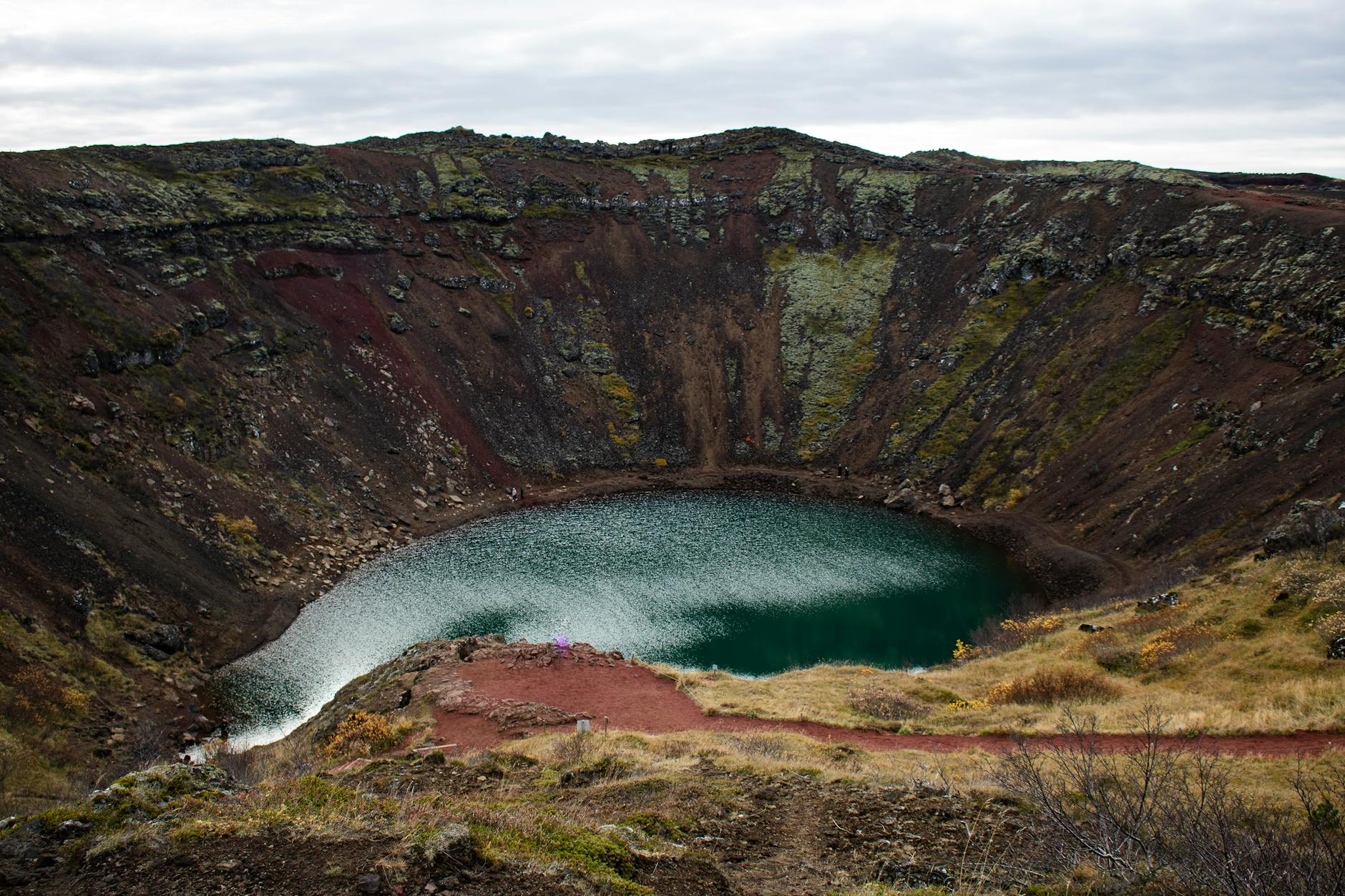
The region is characterised by active and dormant volcanoes, colourful rhyolite mountains, lava deserts, geothermal fields, glaciers and crystal-clear rivers. It opens to visitors between approximately late June and September, when snowmelt allows the F-roads to open safely.

Access requires a 4-wheel-drive vehicle — all routes into the Highlands are legally designated F-roads. But for those who make the effort, the Highlands offer landscapes found nowhere else on Earth.

Landmannalaugar coloursAskja volcanic landscape

Highlands by Difficulty

Choose your level — all require a 4×4 vehicle.

Beginner

Suitable for most 4×4 drivers. No river crossings. F35 Kjölur is well-maintained and the most accessible highland route.

Routes:

F35 Kjölur

Destinations:

  • F35 Kjölur route
  • Hveravellir
  • Kerlingarfjöll

Still requires a 4×4 — no 2WD cars on any F-road.

Intermediate

Some river crossings. Requires confidence in 4×4 driving. Research current road conditions before departure.

Routes:

F208 (north), F225

Destinations:

  • Landmannalaugar (north approach)
  • F225
  • Laugavegur trail

River levels are highest in June — July is safer.

Advanced

Deep river crossings, very remote conditions, limited rescue access. Experienced highland drivers only. Satellite communicator recommended.

Routes:

F88, F249, F26, F208 south

Destinations:

  • Landmannalaugar (south F208)
  • Askja (F88)
  • Þórsmörk (F249)
  • Sprengisandur (F26)

Highland buses are the safest option for Þórsmörk and Landmannalaugar.

Top Highland Destinations

The best places to visit in Iceland's Highlands — ranked by accessibility and experience.

Landmannalaugar
#1

Landmannalaugar

Landmannalaugar 2
F208 / F225Intermediate4×4 required♨️ Hot spring🥾 Hiking

Iceland's most colourful landscape — vivid rhyolite mountains in pink, green and yellow, a natural geothermal hot spring pool and the start of the world-famous Laugavegur hiking trail.

Natural hot spring bathing poolStart of Laugavegur trailRhyolite mountain panoramasCampsite with facilities
Askja
#2

Askja

Askja 2
F88Advanced4×4 required♨️ Hot spring🥾 Hiking

A remote and breathtaking volcanic caldera, 1,100 m above sea level. The Víti explosion crater contains a warm, milky-blue geothermal lake — one of Iceland's most surreal bathing experiences.

Víti crater lake (warm bathing)Öskjuvatn caldera lakeRemote volcanic landscapeDrekagil gorge campsite
Þórsmörk
#3

Þórsmörk

Þórsmörk 2
F249Advanced4×4 required🥾 Hiking

A lush, dramatic valley ringed by three glaciers — Eyjafjallajökull, Mýrdalsjökull and Tindfjallajökull. The end point of the Laugavegur trail and start of the Fimmvörðuháls pass to Skógar.

Laugavegur trail terminusFimmvörðuháls passThree glaciers surrounding valleyHighland buses available
Kerlingarfjöll
#4

Kerlingarfjöll

Kerlingarfjöll 2
F35 KjölurBeginner4×4 required🥾 Hiking

A dramatic mountain range with vivid orange and red geothermal fields. Accessible via the easiest highland route (F35 Kjölur) — ideal for first-time highland visitors.

Gufuver geothermal steam ventsHiking trails (day hikes)Mountain lodge accommodationNo river crossings on F35
Hveravellir
#5

Hveravellir

Hveravellir 2
F35 KjölurBeginner♨️ Hot spring

A magical geothermal oasis in the middle of the Kjölur highland desert. Natural hot spring pool for bathing, mountain huts and a small service hut. The only 'rest stop' in the central highlands.

Natural hot spring poolMountain huts (FÍ)Mid-point on Kjölur routeAccessible via F35 (easiest highland road)
Sprengisandur Desert
#6

Sprengisandur Desert

Sprengisandur Desert 2
F26Advanced4×4 required

Iceland's great highland crossing — a 200 km drive through a bleak black lava desert between two glaciers. No fuel, no services, no phone signal. One of Europe's most remote drives.

200 km route between glaciersNyidalur campsite mid-routeÞórisfell table mountainComplete solitude
Laugavegur Trail
#7

Laugavegur Trail

Laugavegur Trail 2
F208 / F249Intermediate🥾 Hiking

One of the world's great long-distance hiking trails — 55 km from Landmannalaugar to Þórsmörk through lava fields, obsidian deserts, glacier rivers and hot springs. Usually 4 days.

55 km, 4-day trekMountain huts every 15-20 kmDramatic volcanic sceneryNo 4x4 needed (hiking only)
Vonarskarð Pass
#8

Vonarskarð Pass

Vonarskarð Pass 2
F26 (branch)Advanced4×4 required

A remote highland pass between the Hofsjökull and Vatnajökull glacier systems. Extremely isolated — few travellers reach here. Extraordinary views across the highland plateau.

Complete wildernessViews of multiple glaciersVery few visitorsExpert drivers only

Do You Need a 4×4?

All F-roads are legally restricted to 4-wheel-drive vehicles. Here's what you need for each destination.

Standard SUVs (Toyota RAV4, Dacia Duster) handle F35. Advanced routes need a Land Cruiser or similar.

Destination4×4 RequiredNotes
Hveravellir (via F35)RecommendedF35 has no deep crossings. High-clearance recommended.
Kerlingarfjöll (via F35)Yes4WD required by law. F35 is manageable.
Landmannalaugar (north F208)YesMinor crossings. Most capable SUVs fine.
Landmannalaugar (south F208)Yes — largeDeep crossings. Large 4×4 strongly recommended.
Þórsmörk (F249)Yes — largeMultiple deep glacial rivers. Highland bus safer.
Askja (F88)Yes — largeRemote. Lindaá crossing can be waist deep.
Sprengisandur (F26)EssentialNo services for 200 km. Large 4×4 only.
Laugavegur trail (hiking)NoHiking only — no vehicle needed.

When to Visit the Highlands

The Highlands are only accessible in summer. Opening dates vary by 2–4 weeks each year — always confirm at road.is.

May

Closed

All F-roads closed. Snow still deep. No highland access.

June

Opening

F35 opens early June. F208 and others open late June. Check road.is daily.

July

Best

All major routes open. Warmest weather. Busiest month — book huts in advance.

August

Best

All routes open. Good weather continues. River levels stabilise.

September

Good

Quieter, dramatic colours. Routes begin closing mid-September. Check conditions.

October

Closing

Most F-roads closed. Some routes inaccessible after first snowfall.

Highland Hot Springs

The Highlands contain some of Iceland's most extraordinary geothermal bathing — remote, wild and free of charge.

Landmannalaugar

Landmannalaugar

F208 / F225 · ~39°C

Iceland's most famous highland hot spring — a natural pool fed by geothermal water next to the campsite. Free.

Hveravellir

Hveravellir

F35 Kjölur · ~35–40°C

A magical pool in the middle of the highland desert. One of the most atmospheric bathing spots in Iceland. Free.

Víti, Askja

Víti, Askja

F88 · ~22–26°C

A warm, milky-blue crater lake inside the Askja caldera. Surreal and extremely remote — one of Iceland's most unique experiences.

Strútslaug

Strútslaug

F210 · ~38°C

A hidden hot river pool in the Þórsmörk area, accessible by 4×4 or on foot. Very few visitors.

Suggested Itineraries

From a day trip to a full expedition.

1 DayBeginner

Kjölur Classic

  1. 1.Drive Reykjavík → F35 Kjölur (2.5h)
  2. 2.Swim at Hveravellir hot spring
  3. 3.Continue to Kerlingarfjöll viewpoint
  4. 4.Return via Gullfoss and Geysir

~350 km. Suitable for most 4×4 rentals. No river crossings.

2 DaysIntermediate

Landmannalaugar Experience

  1. 1.Day 1: Drive F208 north → arrive Landmannalaugar
  2. 2.Swim in natural hot spring
  3. 3.Day 2: Hike Bláhnúkur (Blue Peak) day hike
  4. 4.Return via F208 or take highland bus back

Stay at Landmannalaugar campsite (book in advance).

3 DaysAdvanced

Askja & Mývatn

  1. 1.Day 1: Fly/drive to Mývatn
  2. 2.Day 2: Early start → F88 to Askja (full day)
  3. 3.Bathe in Víti crater lake
  4. 4.Day 3: Mývatn sights → return

Guided 4×4 tours available from Mývatn — recommended for F88.

4–5 DaysHiking

Laugavegur Trail

  1. 1.Day 1: Travel to Landmannalaugar start
  2. 2.Days 2–4: Hike 55 km to Þórsmörk (mountain huts each night)
  3. 3.Day 5: Fimmvörðuháls to Skógar, bus back

Book FÍ mountain huts months in advance. Hiking only — no 4×4 needed.

Highlands Safety

The Highlands are genuinely remote. Every year travellers get stranded or injured by underestimating conditions. These six precautions are not optional.

🌦️

Check weather before every highland trip

Highland weather changes in minutes. Always check vedur.is for colour-coded warnings (yellow / orange / red). Do not enter the highlands on orange or red warning days.

🛣️

Verify road status on the day

F-roads can close overnight after rain or snow. Check road.is on the morning of your trip. A road listed as open on Monday may be closed on Tuesday.

📋

Register your route with SafeTravel

Before entering the Highlands, submit your travel plan at safetravel.is. In an emergency, rescue teams need to know your route. It takes 2 minutes and could save your life.

Fill up on fuel — there are none in the Highlands

There are no petrol stations inside the Highlands. The last stations are in Reykjavík/Selfoss (south), Hella, Vík, Akureyri or Mývatn (north). For F26 and F88, carry a jerrycan.

📡

Download offline maps — no mobile signal

Mobile coverage is absent in most of the Highlands. Download offline maps using OsmAnd, Maps.me or Google Offline Maps before departure. Download the 112 Iceland emergency app.

🌊

Respect river crossings

Never cross a river you haven't inspected on foot first. Cross at the widest point, use low gear, and turn back if in doubt. River levels rise in the afternoon as glacial melt increases.

Frequently Asked Questions

Everything travellers ask about Iceland's Highlands.

What are the Iceland Highlands?+

The Highlands (Miðhálendi) are Iceland's vast interior plateau — roughly one-third of the country's total area. Sitting at 400–1,000+ metres, this is one of Europe's last true wildernesses: no towns, no permanent inhabitants and roads that are impassable for most of the year.

When do the Highlands open?+

The main highland routes open between early June (F35 Kjölur) and July (F88 Askja, F26 Sprengisandur). Opening dates depend on snowmelt and vary by 2–4 weeks each year. Check road.is before travel — closures can happen at any time.

Do I need a 4x4 for the Iceland Highlands?+

Yes — all roads beginning with 'F' require a 4-wheel-drive vehicle by Icelandic law. Driving a 2WD car on any F-road invalidates your insurance and is illegal. For advanced routes with river crossings (F88, F249, F26), a large-wheelbase 4×4 is strongly recommended.

Can I drive there in September?+

Some routes remain open into September, but conditions deteriorate rapidly. F35 Kjölur typically stays open until mid-September. F88 and F26 may close earlier. First snowfall can close roads overnight. Always check road.is on the day.

Is camping allowed in the Highlands?+

Yes, at designated Highland campsites. Wild camping is not permitted on F-road routes. Main campsites: Landmannalaugar, Þórsmörk (Húsadalur), Askja (Drekagil), Hveravellir and Kerlingarfjöll. Book in advance for July and August.

Are there fuel stations in the Highlands?+

No. There are zero fuel stations in the entire Highland interior. For most routes, fill up in Reykjavík, Selfoss, Hella or Vík before heading south, or Akureyri/Mývatn before heading north. For F26 Sprengisandur, carrying a fuel jerrycan is essential.

Is there mobile coverage in the Highlands?+

Very limited. Coverage exists near some larger campsites (Landmannalaugar, Hveravellir) and in river valleys, but most of the interior has no signal. Download offline maps and the 112 Iceland emergency app before departure.

Can I reach the Highlands without a car?+

Yes — highland buses run from Reykjavík to Landmannalaugar and Þórsmörk daily in summer (late June to mid-September). For Askja, guided 4×4 tours from Mývatn are the most practical option. The Laugavegur trail is accessible by bus at both ends.

Official Sources

Continue Exploring