Bæjarfell - gönguleið
Hike Bæjarfell for panoramic views of Drangsnes, Húnaflói bay, and the Westfjords' majestic landscapes.
About
About Bæjarfell - gönguleið
Hike Bæjarfell for panoramic views of Drangsnes, Húnaflói bay, and the Westfjords' majestic landscapes.
Experience stunning panoramic views of the Westfjords, bay, and coastal town from a popular summit.
Photos
Photo Gallery
Background
History & Background
Bæjarfell mountain has long been a prominent landmark in the Strandir area of the Westfjords, towering above the small coastal town of Drangsnes. Its strategic location has historically made it a natural point of reference and a place from which to survey the surrounding landscape, including the expansive Húnaflói bay and the rugged northern Strandir coastline. Over time, the mountain has become renowned for its accessible hiking trail, known as 'Bæjarfell – gönguleið.' This trail has served as a beloved recreational route for generations of locals from Drangsnes, offering both exercise and an opportunity to connect with their natural surroundings. In recent years, as the Westfjords have gained recognition as a prime destination for nature tourism, the Bæjarfell trail has also attracted a growing number of visitors. It stands as a testament to the region's raw beauty, providing a well-trodden path that allows both residents and travelers to experience the dramatic Icelandic terrain and its breathtaking panoramic vistas.
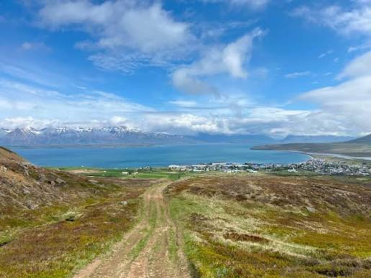
Bæjarfell – gönguleið, a captivating hiking trail in the Westfjords, offers outdoor enthusiasts a unique opportunity to immerse themselves in Iceland's remarkable natural beauty. Situated directly above the charming town of Drangsnes, Bæjarfell mountain stands at 345 meters above sea level, providing an unparalleled vantage point. The trail itself, visible as a clear dirt path winding through grassy, brown-hued hills in the image, is well-marked and relatively short, making it accessible for many. From the summit, the panoramic views are truly spectacular, encompassing the vast, tranquil blue waters of Húnaflói bay, the picturesque settlement of Drangsnes nestled along the shore, and the majestic, snow-capped mountains of the northern Strandir region stretching into the distance under a dramatic sky. This enjoyable route is a favorite among both locals and visitors, promising a memorable experience. Hikers should allocate approximately 2-3 hours for the round trip, ensuring ample time to soak in the breathtaking scenery. Proper footwear and weather-appropriate clothing are highly recommended, and it's always wise to check trail conditions before embarking on your journey, especially outside of the summer months, to fully enjoy this iconic Westfjords hike.
Folklore
Story & Folklore
The dirt path winding up Bæjarfell beckons, a ribbon of green and brown cutting through the rugged Icelandic landscape. With each step upward, the world expands, revealing the vibrant blue expanse of Húnaflói bay mirroring the cloudy sky. Below, the colorful rooftops of Drangsnes hug the coastline, a charming punctuation mark against the grandeur of nature. Distant snow-capped peaks shimmer under the sun, a testament to the raw beauty of the Westfjords. This trail isn't just a climb; it's a journey into Iceland's soul, a chance to breathe in the crisp air and witness a panorama that stretches to the horizon, a view cherished by every local and traveler who has ever made the rewarding ascent.
💡 Did You Know?
Bæjarfell, standing 345 meters above sea level, provides an exceptional vantage point over Húnaflói bay and the northern Strandir coastline.
Help
Frequently Asked Questions
Location
📍 Location
Discover
Explore Nearby
Places from our database within 1.0 km — all data from Sanity
Loading nearby places…
0 places found within 1.0 km
Plan full itinerary →Explore More