

Sjálfakstursleiðin
Askja & Möðrudalsöræfi
Remote volcanic Highlands and the Askja caldera
A remote 4x4 journey through Möðrudalsöræfi to Herðubreið, Drekagil and Askja.
Askja is one of Iceland’s most rewarding but demanding self-drive destinations. This is a summer-only Highlands journey on rough mountain roads where conditions can change quickly and river crossings may be part of the route. Treat the drive itself as a major part of the day: start with a full tank, use a suitable 4x4 permitted on F-roads, check live road and weather information immediately before departure, and be prepared to turn back.
Winter Warning
Askja is not a normal winter self-drive destination. Do not attempt the route while Highlands roads are closed; seasonal opening varies from year to year.
Must See
Main Highlights
Askja Caldera & Víti
The volcanic heart of the route: a vast caldera landscape reached only after a long Highlands drive and final walk.
Herðubreið & Herðubreiðarlindir
Iceland’s distinctive table mountain and the green oasis at its foot are defining landmarks on the approach to Askja.
Drekagil
A rugged gorge and important highland base close to Askja, useful for a break before or after the caldera visit.
Meðfram leiðinni
Stöðvar og uppáhöld
6 staðir sem þarf að sjá

Möðrudalur
Möðrudalur liggur hæst bæja á Íslandi, er ein landmesta jörð landsins og þar hefur verið búið frá fyrstu öldum Íslandsbyggðar. Jón Stefánsson (1880-1971) bóndi reisti kirkju þar til minningar um konu sína. Hann smíðaði kirkjuna sjálfur og málaði altaristöfluna sem þykir sérstæð. Möðrudalur er fallegur staður og þar er birtan engu lík. „Þar liggur sagan við hvert fótmál þar sem ábúendur hafa búið mann fram af manni í sátt og samlyndi við náttúruna." Einnig hefur Stefán Stórval gert fjallasýninni og Herðubreið ógleymanleg skil. Á Möðrudal eru friðlýstar fornminjar, „fornbæjarrústir, ónafnkenndar, er fundist hafa eigi all skammt norður frá bænum".

Herðubreið - Queen of Mountains
Iceland's most beautiful mountain (1,682m table volcano) called 'Queen of Mountains' — isolated Highlands icon.

Herðubreiðarlindir
Herðubreiðarlindir er friðlýst vin norðvestan við Herðubreið í Vatnajökulsþjóðgarði. Fjölmargar kaldar lindir renna í Lindaá og halda uppi óvenju gróskumiklum gróðri í þurrum eldfjallahálendinu umhverfis. Þjóðgarðurinn lítur á Herðubreiðarlindir sem sjálfstæðan áfangastað, með landvörðum yfir sumarið og neti merktra gönguleiða allt frá stuttum leiðum um hraunbreiður til hinnar krefjandi göngu á Herðubreið.

Drekagil
Drekagil, sem þýðir "Drekagil" eða "Drekaskarð", er stórbrotin og hrikaleg hamragil á norðanverðu hálendi Íslands. Dökkar, háar veggir þess, mótaðir af fornum jöklum, umlykja glitrandi á og snjóskellur sem liggja eftir, og bjóða upp á sannarlega villt og lotningarfullt landslag.

Askja Caldera
Remote volcanic caldera with warm Víti crater lake

Askja og Víti
Ferðastu til Askju og Vítis, framúrskarandi jarðfræðilegs undurs í afskekktum miðhálöndum Íslands. Þessi öfluga hálendiseldstöð státar af risastórri öskju og heillandi, mjólkurbláu jarðhitavatni Vítis, sem eitt sinn var æfingasvæði fyrir geimfara NASA.
Dagsáætlun
Ráðlögð ferðaáætlun
07:30
Möðrudalur
Start early with fuel, food, water and current road/weather checks completed.
09:30
Herðubreið / Herðubreiðarlindir
Short scenic and rest stop; progress depends entirely on road and river conditions.
11:00
Drekagil / Dreki
Break and reassess conditions before the final approach to Askja.
12:00
Askja & Víti
Allow 2.5–4 hours for the caldera visit, walking and weather margin.
16:00
Return drive
Leave generous daylight and time margin for the long Highlands drive out.
Self-Drive Plans
Alternative Itinerary Options
Choose the plan that fits your schedule.
Long Summer Day Trip
Full day — typically 10–14+ hoursFor experienced Highlands drivers starting close to Möðrudalur or the Mývatn area. The exact timing depends heavily on road, river and weather conditions.
Do not plan this as a tightly timed sightseeing day. Turn back if road, river, visibility or weather conditions deteriorate.
2-Day Askja Highlands Trip
2 daysThe recommended relaxed option: use the first day for the remote approach and Highlands stops, then give Askja and the return journey proper time on day two.
A two-day plan provides more margin, but it does not make unsafe road or river conditions acceptable. Recheck conditions each day.
Before You Go
Practical Information
Trip Duration
1–2 days
Starting Point
Mývatn or Möðrudalur
Best Time to Visit
Only during the summer period when the relevant Highlands roads are officially open and current weather and river conditions are suitable. Do not use a calendar date alone to decide whether the route is driveable.
Road Conditions
This is a Highlands/F-road journey on rough gravel and mountain tracks. Access is seasonal and conditions can change rapidly. A suitable 4x4 is required, and river crossings may become unsafe or impassable after rain or during high flow.
Weather
Expect rapid changes, strong wind, cold temperatures and poor visibility even in summer. Check the forecast before entering the Highlands and keep a large weather margin.
Fuel
Start with a full tank and enough range for the complete Highlands section plus a reserve. Do not assume fuel is available once you leave the main-road settlements.
Food
Carry all food and drinking water needed for the day plus emergency reserve supplies. Do not plan around finding cafés or shops in the Highlands.
Parking
Use established parking and stopping areas only. At Askja, park at the designated visitor parking area and continue on foot as directed by signs and rangers.
Toilets
Basic seasonal facilities may be available around staffed highland huts such as Dreki. Availability is seasonal, so do not rely on every facility being open.
Safety
Never enter a river crossing simply because another vehicle crossed it. Water depth and flow can change quickly. If uncertain, turn back. Driving off marked roads or tracks is prohibited.
Accessibility
The drive is long and rough, and the Askja visit includes walking on uneven volcanic terrain. This is not an accessible conventional sightseeing route.
Winter Driving
Do not treat Askja as a winter self-drive route. Mountain-road access is seasonal and roads can remain closed well into summer.
Opening Hours
There is no fixed annual opening date. Highland roads open only when authorities consider them passable; always check the current road status immediately before departure.
Book Now
Tours & Activities
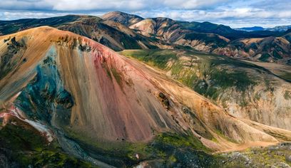 8 hours 30 minutes
Landmannalaugar Highlands | Day Tour | Midgard
Midgard Adventure
Frá
45,000 ISK
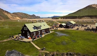 10 hours
Into the Highlands: Private Landmannalaugar Day Tour – Now Available for Summer 2025
Daytrips / TA Sport Travel
Frá
275,000 ISK
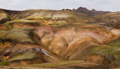 8 hours
Landmannalaugar Super Jeep Day Tour
Southcoast Adventure
Frá
44,990 ISK
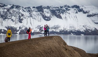 12 hours
Askja & Herðubreið Super Jeep Tour
Iceland Horizon - Saga Travel - GeoIceland
Frá
59,900 ISK
 9 hours 30 minutes
Private Day Trip in Landmannalaugar from Reykjavík
FG private tours
Frá
204,649 ISK
 9 hours 30 minutes
Private Day Trip in Landmannalaugar South Region area on a 4x4 truck
FG private tours
Frá
190,000 ISK
Innherjaþekking
Ferðaráð
Check live road conditions and the weather immediately before entering the Highlands — not only the night before.
Use a suitable 4x4 and confirm that your rental agreement explicitly permits the roads you intend to drive.
Never attempt a river crossing you cannot confidently assess. Conditions can change during the same day.
Start with a full tank and carry extra food, drinking water, warm layers and waterproof clothing.
Download offline maps and tell someone your route and expected return time; mobile coverage can be unreliable.
Stay strictly on marked roads, tracks and walking paths. Off-road driving is illegal and can permanently damage fragile Highlands terrain.
Fun Facts
Did You Know?
Askja lies within the Dyngjufjöll volcanic system in Iceland’s remote central Highlands.
Herðubreið is one of Iceland’s best-known table mountains and is often called the Queen of Icelandic Mountains.
Drekagil is an established Highlands base close to Askja and is used by many travellers exploring the area.
Rent a car for this self-drive route
Self-drive is the best way to follow this route. Browse vehicle types, then search real availability and prices on DiscoverCars.
- Smábílar / sparneytnir
Leitaðu til að sjá lausa bíla
Ódýrasti kosturinn fyrir bæjarakstur og malbikaða vegi.
Finna bíla - Millistórir smábílar
Leitaðu til að sjá lausa bíla
Aðeins meira rými og þægindi, enn auðvelt að leggja.
Finna bíla - Millistærð / fjölskyldubílar
Leitaðu til að sjá lausa bíla
Þægilegur í lengri ferðir um hringveginn með farangur.
Finna bíla - Jepplingar (SUV)
Leitaðu til að sjá lausa bíla
Meiri veghæð og öruggari akstur.
Finna bíla
Flokkamyndir fyrir leit eru dæmamyndir frá DiscoverCars, ekki rauntímaframboð. Raunverulegir bílar og verð koma úr þinni eigin leit með dagsetningum. GoIceTravel kann að fá þóknun án aukakostnaðar.
Nearby
Nearby Attractions
Askja Caldera
Remote volcanic caldera with warm Víti crater lake
Askja og Víti
Ferðastu til Askju og Vítis, framúrskarandi jarðfræðilegs undurs í afskekktum miðhálöndum Íslands. Þessi öfluga hálendiseldstöð státar af risastórri öskju og heillandi, mjólkurbláu jarðhitavatni Vítis, sem eitt sinn var æfingasvæði fyrir geimfara NASA.
Herðubreið - Queen of Mountains
Iceland's most beautiful mountain (1,682m table volcano) called 'Queen of Mountains' — isolated Highlands icon.
Herðubreiðarlindir
Herðubreiðarlindir er friðlýst vin norðvestan við Herðubreið í Vatnajökulsþjóðgarði. Fjölmargar kaldar lindir renna í Lindaá og halda uppi óvenju gróskumiklum gróðri í þurrum eldfjallahálendinu umhverfis. Þjóðgarðurinn lítur á Herðubreiðarlindir sem sjálfstæðan áfangastað, með landvörðum yfir sumarið og neti merktra gönguleiða allt frá stuttum leiðum um hraunbreiður til hinnar krefjandi göngu á Herðubreið.
Drekagil
Drekagil, sem þýðir "Drekagil" eða "Drekaskarð", er stórbrotin og hrikaleg hamragil á norðanverðu hálendi Íslands. Dökkar, háar veggir þess, mótaðir af fornum jöklum, umlykja glitrandi á og snjóskellur sem liggja eftir, og bjóða upp á sannarlega villt og lotningarfullt landslag.
Read More
Related Guides


Kanna meira
Nálægar leiðir


Algengar spurningar
Algengar spurningar
Can I drive to Askja in a normal car?+
No. This is a remote Highlands route requiring a suitable 4x4. You must also confirm that your rental agreement allows the specific F-roads you plan to use.
When is the road to Askja open?+
There is no reliable fixed opening date. Highlands roads open only when conditions allow, so check the official road status immediately before travel.
Are there river crossings on the way to Askja?+
River crossings can be part of Highlands routes in this area. Their depth and flow vary with rain, temperature and snowmelt. Never cross when you are uncertain about safety.
How long should I allow for Askja?+
Treat it as a very long full-day trip from the nearest practical bases, or preferably a two-day Highlands journey. Road conditions can make travel much slower than the distance suggests.
Can I visit Askja in winter?+
Not as a normal independent self-drive trip. Highlands mountain roads are seasonal and closed when conditions are unsuitable.
Is Askja suitable for inexperienced 4x4 drivers?+
It is not a good first Highlands drive. The route is remote, rough and condition-dependent, and drivers may need to assess river crossings and changing weather.
Vilt þú aðlaga þessa leið?
Smíðaðu þína eigin Askja & Möðrudalsöræfi ferðaáætlun með gervigreindarlega ferðaskipuleggjandanum. Bættu við stöðvum, hótelum og ferðum.
Looking for individual attractions? Browse things to do in Iceland