
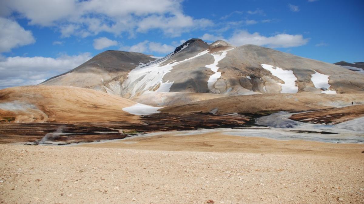
Vonarskarð
A roadless Highland pass and watershed with a remarkable high-temperature geothermal area, reached only on challenging marked hikes.
At a Glance
Visit time
3–10 hours depending on the chosen marked route; N6 from Nýidalur is a long full-day hike.
Best Season
Summer, when the marked approaches are sufficiently snow-free and weather is suitable for long Highland hiking.
Getting There
No road enters Vonarskarð. Use one of the marked Vatnajökull National Park hiking routes from Nýidalur, Svarthöfði/Kolufell or Gjósta/Gjóstuklif. Do not rely on mobile or TETRA coverage.
GPS
64.7150, -17.7352
About
About Vonarskarð
A roadless Highland pass and watershed with a remarkable high-temperature geothermal area, reached only on challenging marked hikes.
Experience one of Iceland's most remote protected Highland landscapes, combining a major watershed, colourful geothermal terrain and demanding wilderness hiking with no road access into the pass itself.
Photos
Gallery
Background
History & Background
Vonarskarð has long been one of the more difficult interior passages in Iceland. Vatnajökull National Park notes a tradition that the settler Gnúpa-Bárður may have travelled through the pass in the Settlement Age, although the first recorded journey through the area is from around 1839. The remoteness that shaped those journeys remains today: there is still no road into the pass, and modern visitors reach it on foot.
Vonarskarð is a protected wilderness destination in the Nýidalur and Tungnaáröræfi area of Vatnajökull National Park. Its combination of watershed, high-temperature geothermal activity, high-altitude vegetation and surrounding glaciers gives the pass exceptional conservation and geological value. The geothermal activity is most visible around Hverahlíð beneath Eggja and in Hverabotn. Access is entirely on foot through a network of challenging marked routes. N6 makes a long out-and-back journey from Nýidalur; N7 approaches from Svarthöfði and Kolufell; N9 begins at Gjóstuklif/Gjósta. The terrain is remote, weather can change quickly and there is no dependable phone or TETRA coverage, so visitors must be self-sufficient and prepared to navigate.
Folklore
Story & Folklore
Vonarskarð is defined by movement in opposite directions. Small streams rise close together in the pass, yet some eventually flow north through Skjálfandafljót while others run south through Kaldakvísl and Tungnaá. Beneath this watershed lies a powerful geothermal system. Hverahlíð and Hverabotn contain hot springs and geothermal formations at unusually high elevation, while glaciers, rhyolite screes, sand plains and alpine vegetation surround them. The pass has no road and remains a true hiking destination rather than a drive-up stop.
Did You Know?
There is no road into Vonarskarð: visitors reach it on foot from Nýidalur, Gjósta/Gjóstuklif or Svarthöfði/Kolufell.
Explore
Hidden Gems Nearby
Hverahlíð
The most visible high-temperature geothermal area in Vonarskarð, beneath Eggja, with varied geothermal formations and warm drainage streams.
It is the core geothermal feature reached by several of the official marked routes.
The watershed
Streams rising close together in Vonarskarð eventually drain toward opposite sides of Iceland through Skjálfandafljót and Kaldakvísl.
The pass lets hikers stand in a landscape where Iceland's north–south drainage divide is directly visible.
Tvílitaskarð route
A marked circular hike around Kolufell with views into Vonarskarð, varied hyaloclastite and rhyolite formations and a quiet mountain lake.
It provides a shorter way to experience the wider Vonarskarð landscape without committing to the full N6 route.
Help
Frequently Asked Questions
Location
Location
Discover
Explore Nearby
Places within 5.0 km
Loading nearby places…
0 places found within 5.0 km
Plan full itinerary →Explore More