
Þverárgil
Þverárgil: A stunning East Iceland canyon, revealing unique rhyolite formations and dramatic river-carved landscapes.
About
About Þverárgil
Þverárgil: A stunning East Iceland canyon, revealing unique rhyolite formations and dramatic river-carved landscapes.
Witness dramatic geological formations, including rare rhyolite, carved by powerful forces in a stunning Icelandic river canyon.
Photos
Gallery
Background
History & Background
Þverárgil's history is etched in its very rock. Formed over millennia, this canyon is a powerful example of Iceland's dynamic geological processes, shaped by a potent combination of ancient volcanic activity and subsequent glacial erosion. The canyon walls vividly tell the story of this past, displaying layers and formations that reveal the island's fiery origins and the immense forces that sculpted its landscape. A key aspect of Þverárgil's geological narrative is the presence of rhyolite. Unlike much of Iceland, which is characterized by dark basalt, this canyon features lighter rhyolitic rock. This unique material is believed to have originated from a volcanic dike linked to the ancient main volcano in Refsstaðafjall or Búrið, making Þverárgil a rare and significant site for understanding Iceland's diverse volcanic geology.
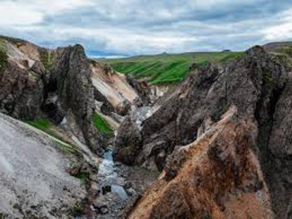
Þverárgil, nestled in the scenic Vopnafjörður region of East Iceland, is a testament to the island's powerful geological forces. This picturesque canyon, carved by the relentless flow of the Þverá river over thousands of years, offers a truly unique hiking experience. What sets Þverárgil apart is the striking presence of rhyolite rock within an otherwise predominantly basaltic landscape. This lighter-colored, often more vibrant rock originated from a dike connected to the ancient main volcano of Refsstaðafjall or Búrið, providing a fascinating glimpse into Iceland's fiery past. The hiking trail, stretching 4.2 km one way from Þverárbrú, guides visitors along the eastern bank of the Þverá river. The journey begins with a climb over a steep gravel slope, gradually giving way to more level terrain as you proceed deeper into the gorge. Along the way, hikers are treated to a continuous display of peculiar and dramatic rock formations. The canyon walls, as seen in the accompanying image, showcase a stunning palette of greys, browns, and reddish hues, with patches of green vegetation clinging to the slopes, creating a vivid contrast. The river itself, a vital sculptor of this landscape, winds through the canyon floor, adding to the serene yet powerful atmosphere. The trail typically turns back at a point known as Gjá, a section described as difficult to pass, ensuring a rewarding and memorable exploration of this geological wonder.
Folklore
Story & Folklore
The journey into Þverárgil begins at Þverárbrú, following the Þverá river upstream. Initially, the path winds over a steep gravel slope, a prelude to the geological marvels ahead. As you delve deeper, the landscape flattens slightly, but the true drama unfolds along the river gorge. Towering, jagged rock formations, sculpted by millennia of glacial and fluvial erosion, rise on either side. Here, the unique rhyolite, a vibrant contrast to the surrounding darker basalt, reveals itself in striking veins and cliffs, hinting at ancient volcanic forces. The river, a ribbon of clear water, carves its way through the canyon floor, its murmur a constant companion. Patches of vivid green moss cling to the slopes, softening the rugged edges, while the vast, cloudy Icelandic sky frames this natural masterpiece, inviting quiet contemplation of earth's raw power.
Did You Know?
Þverárgil is unique for its rhyolite rock, a geological rarity in Iceland's typically basaltic landscape, originating from the ancient Refsstaðafjall volcano.
Explore
Hidden Gems Nearby
The Rhyolite Veins
Keep an eye out for the stunning veins of lighter-colored rhyolite contrasting against the darker basalt walls. These unique geological formations are a highlight of the canyon.
They offer a rare glimpse into a different aspect of Iceland's volcanic history.
Gjá Gorge
The turnaround point for the hike, Gjá is described as a 'difficult-to-pass gorge'. While you won't proceed beyond it, the formations leading up to it are particularly dramatic and impressive.
It marks the deepest, most rugged part of the accessible canyon trail.
Help
Frequently Asked Questions
Location
Location
Discover
Explore Nearby
Places within 5.0 km
Loading nearby places…
0 places found within 5.0 km
Plan full itinerary →Explore More