
Þeistareykir
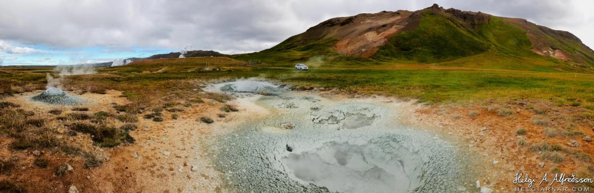
Witness Earth's raw power at Þeistareykir, a vibrant geothermal area with bubbling mud pots.
At a Glance
Visit time
1–2 hours
Best Season
Late Spring to Early Autumn (May-September)
Getting There
Paved road access leads to the general area, but some exploration within the geothermal field might involve gravel paths. A 4WD vehicle is recommended for exploring more remote parts of the region, though the main site is generally accessible.
GPS
65.8800, -16.8400
About
About Þeistareykir
Witness Earth's raw power at Þeistareykir, a vibrant geothermal area with bubbling mud pots.
Experience the dramatic, untamed geothermal activity and unique volcanic landscapes of North Iceland.
Tours Near Þeistareykir
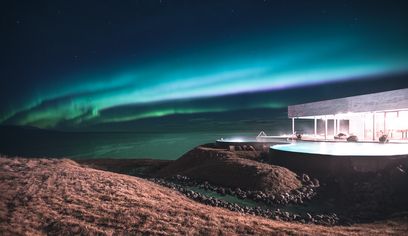
Private Northern Lights & GeoSea Geothermal Baths Tour (from Akureyri)
Imagine Iceland Travel · 5 hours

Northern Lights Photography tour from Akureyri
Iceland Horizon - Saga Travel - GeoIceland · 3 hours
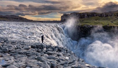
Dettifoss Waterfall, Ásbyrgi and Lake Mývatn - Shore Excursion from Húsavík
BusTravel Iceland · 5 hours 30 minutes
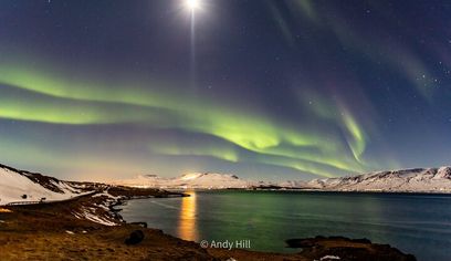
Akureyri Northern Light Tour
The Traveling Viking · 2 hours 30 minutes
Photos
Gallery
Background
History & Background
Þeistareykir's history is primarily geological, rooted in its position within Iceland's active volcanic zone. The area is part of a major central volcano and is characterized by a prominent fissure system, approximately 4-5 km wide, that runs almost north-south, extending from the Mývatn region in the south all the way north to the sea in the western part of Kelduhverfi. This extensive system is responsible for the intense heat and pressure that manifest as the geothermal features seen today. The surface geothermal features at Þeistareykir are typical of a high-temperature area. Evidence of this powerful subterranean activity is abundant, with bubbling mud pots (leirhverir), steam vents (gufuaugu), sulfur mounds (brennisteinsþúfur), and widespread alteration of the ground (ummyndun) being common sights. The area's significance is further underscored by its inclusion in the natural monument registry of Northeast Iceland. This designation is due to its diverse geological formations, the unique steam and mud pots, the distinctive mineral deposits found on the northern slopes of Bæjarfjall and by Bóndhól, and the presence of specialized geothermal plants that thrive in these harsh conditions.
Þeistareykir, a significant geothermal and volcanic area in North Iceland, offers a dramatic glimpse into the Earth's dynamic forces. Named after a nearby abandoned farm, this region is intrinsically linked to an active central volcano, driving the intense geothermal activity visible across the landscape. Visitors are greeted by a surreal panorama of bubbling mud pots, vigorous steam vents, and distinctive sulfur mounds, all classic hallmarks of a high-temperature geothermal field. Unlike some other areas, Þeistareykir is notable for its lack of water hot springs, focusing instead on the raw power of steam and mud. The vibrant colors of the landscape, from the reddish-brown earth around the steaming features to the rich green of the surrounding hills and the mineral-stained slopes of Bæjarfjall, create a photographer's dream. This area is designated a natural monument, recognized for its diverse geological formations, unique geothermal flora, and the impressive deposits found in the northern slopes of Bæjarfjall and near Bóndhól. A visit to Þeistareykir is an immersive experience, allowing you to walk amidst the visible breath of the planet, where the ground itself is a canvas of geological artistry.
Folklore
Story & Folklore
Imagine stepping onto this otherworldly landscape, the air thick with the scent of sulfur and the rhythmic plop of bubbling mud. The ground, a tapestry of reds, browns, and pale greens, hums with unseen energy. Steam rises in ghostly tendrils from conical mounds of grey earth and cracked, simmering pools, painting a dramatic contrast against the vibrant green slopes of the distant mountains. A lone white SUV, a tiny speck against the vastness, underscores the wild, untouched nature of Þeistareykir. This isn't just a place to observe; it's a place to feel the pulse of a living planet, a testament to Iceland's fiery origins and ongoing geological drama. The very ground beneath your feet whispers tales of ancient eruptions and the constant dance between fire and ice.
Did You Know?
Þeistareykir is part of a 4-5 km wide fissure system stretching from Mývatn to the coast, making it a significant part of Iceland's active volcanic heart.
Explore
Hidden Gems Nearby
Bæjarfjall's Mineral Deposits
Explore the northern slopes of Bæjarfjall mountain to discover vibrant mineral deposits, showcasing a spectrum of colors from the geothermal activity. These colorful streaks are a testament to the rich geological processes at play.
It's a stunning visual display of Earth's artistry, often overlooked by those focused solely on the mud pots.
Geothermal Flora
Look closely for unique plant species that have adapted to thrive in the warm, mineral-rich soil around the geothermal features. These hardy plants are a fascinating example of life in extreme environments.
They offer a glimpse into the surprising resilience of nature amidst the harsh geothermal conditions.
Fissure System Views
While walking, try to identify the subtle geological lines and cracks in the landscape that are part of the extensive N-S fissure system. Understanding this larger context reveals the scale of the volcanic activity.
It provides a deeper appreciation for the immense geological forces shaping this unique landscape.
Help
Frequently Asked Questions
Location
Location
Discover
Explore Nearby
Places from our database within 5.0 km — all data from Sanity
Loading nearby places…
0 places found within 5.0 km
Plan full itinerary →Explore More