
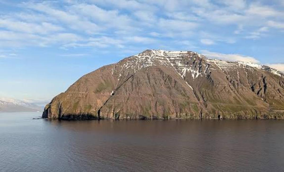
Ólafsfjarðarmúli
Ólafsfjarðarmúli is a majestic mountain-sea landscape in North Iceland, showcasing dramatic geological formations.
At a Glance
Visit time
2-3 hours for a hike along the old road; 30 minutes for a quick scenic stop.
Best Season
Summer (June-August) for hiking; clear days for best views.
Getting There
Accessible via Route 82, passing through the Múlagöng tunnel. The old Múlavegurinn road, now a hiking trail, can be accessed from designated points near the tunnel entrances.
GPS
66.0906, -18.5501
About
About Ólafsfjarðarmúli
Ólafsfjarðarmúli is a majestic mountain-sea landscape in North Iceland, showcasing dramatic geological formations.
Experience a breathtaking landscape where towering cliffs meet the sea, revealing Iceland's raw geological power.
Tours Near Ólafsfjarðarmúli
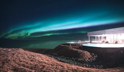
Northern Lights & GeoSea Geothermal Baths Tour (From Akureyri)
Imagine Iceland Travel · 5 hours
Private Northern Lights & GeoSea Geothermal Baths Tour (from Akureyri)
Imagine Iceland Travel · 5 hours
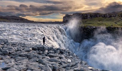
Dettifoss Waterfall, Ásbyrgi and Lake Mývatn - Shore Excursion from Húsavík
BusTravel Iceland · 5 hours 30 minutes
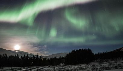
(RS) Northern Lights Classic Tour from Akureyri
Imagine Iceland Travel · 2 hours 30 minutes
Photos
Gallery
Background
History & Background
Ólafsfjarðarmúli has long stood as a formidable natural barrier, geographically separating the communities of Ólafsfjörður from those in Eyjafjörður. Its immense geological significance is evident in the varied landscape, which bears the imprints of powerful natural forces: ancient marine formations, extensive glacial activity that carved its dramatic profile, and evidence of significant landslides. These features collectively tell a compelling story of Iceland's dynamic geological past, shaped by both volcanic processes and the relentless erosion of ice. For centuries, traversing Ólafsfjarðarmúli was a challenging endeavor, highlighting its role as a significant obstacle to regional connectivity. This changed with the construction of the Ólafsfjarðarvegur road, an ambitious project that finally opened on September 17, 1966. This road provided a vital link, significantly improving travel and communication between the two fjords. However, the most exposed and northern parts of the original road were eventually rendered obsolete with the opening of the Múlagöng tunnel in 1991. This modern engineering marvel bypasses the most dangerous sections of the Múli, ensuring safer and more reliable passage. The legacy of the old road, now known as Múlavegurinn, lives on as a popular and picturesque hiking trail, allowing visitors to walk in the footsteps of previous generations while marveling at the geological grandeur that once presented such an imposing challenge.
Ólafsfjarðarmúli is a majestic and geologically diverse mountain that serves as a natural divide between the tranquil waters of Ólafsfjörður and the expansive Eyjafjörður in North Iceland. This formidable landmass is a living textbook of Earth's history, showcasing a remarkable array of geological formations, including ancient marine deposits, powerful glacial carvings, and dramatic landslides. The image vividly captures its imposing scale, with stratified brown cliffs rising directly from the sea, adorned with patches of vibrant green vegetation and crowned by lingering snow on its upper slopes. The flora here is notably rich and varied, characteristic of the outer headlands of Eyjafjörður, providing a verdant contrast to the rugged rock. Historically, Ólafsfjarðarmúli presented a significant challenge for travel. The original Ólafsfjarðarvegur road, a feat of engineering, was laid across the Múli and officially opened on September 17, 1966. However, the most northern and hazardous section of this road was superseded by the opening of the Múlagöng tunnel in 1991, significantly improving access and safety. Today, the abandoned section of the old Múlavegur road has been transformed into a captivating hiking trail. This path offers visitors a unique opportunity to explore the diverse landscape up close, providing stunning panoramic views of the fjords and a chance to truly appreciate the sheer scale and geological intricacies of Ólafsfjarðarmúli. It's a journey through time, revealing both the raw power of nature and the ingenuity of human adaptation in the face of such grandeur.
Folklore
Story & Folklore
As the northern Icelandic light bathes the landscape, Ólafsfjarðarmúli emerges from the mist, a formidable guardian between two fjords. Its sheer, layered cliffs, etched by millennia of ice and ocean, plunge directly into the dark, reflective waters. Streaks of lingering snow crown its upper reaches, a stark contrast to the deep brown and green hues of the rock and sparse vegetation clinging precariously. One can almost hear the echoes of early travelers who once navigated the perilous Ólafsfjarðarvegur, a testament to human perseverance against nature's grandeur. Today, walking the remnants of that old road, now a peaceful trail, offers a profound connection to Iceland's raw beauty and its enduring spirit. The air is crisp, carrying the scent of the sea, and the silence is broken only by the distant calls of seabirds, making this a truly immersive experience into the heart of North Iceland's dramatic coastline.
Did You Know?
Did you know the old Ólafsfjarðarvegur road, opened in 1966, once traversed Ólafsfjarðarmúli? Today, parts of it are a scenic walking trail after the Múlagöng tunnel opened in 1991.
Explore
Hidden Gems Nearby
Old Múlavegurinn Hiking Trail
The former Ólafsfjarðarvegur road, now a scenic hiking trail, winds along the mountain's base, offering unparalleled views of the fjords and intimate access to the geological formations. It's a peaceful walk away from the main road.
It's a unique chance to walk a historic path, combining stunning scenery with a sense of the past.
Geological Observation Points
Along the old Múlavegurinn trail, there are numerous spots to closely examine the stratified rock faces, revealing the distinct layers formed by ancient marine deposits, glacial movements, and landslides. These tell the story of Iceland's dynamic geological evolution.
Offers an up-close and personal look at the geological forces that shaped this dramatic landscape.
Help
Frequently Asked Questions
Location
Location
Discover
Explore Nearby
Places within 5.0 km
Loading nearby places…
0 places found within 5.0 km
Plan full itinerary →Explore More