
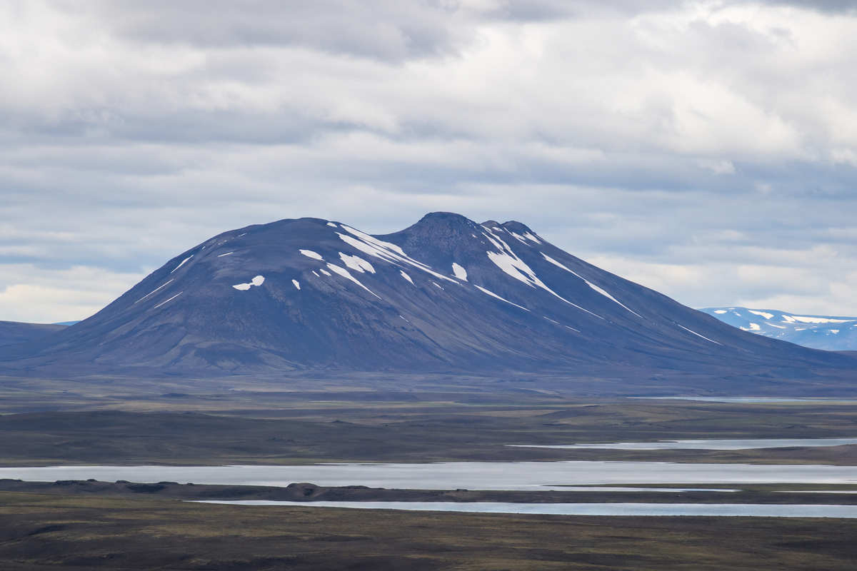
Laugafellshnjúkur
Remote mountain peak near Laugafell in the central Highlands.
At a Glance
Visit time
2-4 hours for a summit hike, 30 minutes to 1 hour for a scenic viewpoint stop and short walk.
Best Season
Late morning to afternoon for optimal light, Summer (June-August) for hiking conditions.
Getting There
Access requires a 4WD vehicle for the highland F-roads. Hiking trails are unmarked and challenging.
GPS
64.9927, -18.3604
About
About Laugafellshnjúkur
Remote mountain peak near Laugafell in the central Highlands.
For expansive central-highland scenery and a strong sense of Iceland’s remote interior.
Photos
Gallery
Background
History & Background
Laugafellshnjúkur's history is deeply rooted in Iceland's geological narrative. The mountain itself is a product of ancient volcanic eruptions, likely forming as a subglacial volcano during an ice age, where lava erupted beneath a thick ice sheet. This process often creates distinctive 'tuff' mountains, characterized by their steep slopes and flat tops, though Laugafellshnjúkur exhibits a more conical, rounded form, suggesting a later stage of erosion or different eruptive style. Following its volcanic birth, the mountain, along with the entire Icelandic landscape, was profoundly sculpted by successive glacial periods. The relentless movement of vast ice sheets carved valleys, smoothed out rock faces, and deposited sediment, leaving behind the rugged yet expansive terrain visible today, complete with numerous glacial lakes. The name 'Laugafellshnjúkur' itself connects the peak to Icelandic culture; 'Laugafell' refers to a nearby mountain range and often implies hot springs or baths ('laug'), while 'hnjúkur' simply means 'peak' or 'summit.' Many Icelandic peaks carry names that echo the island's sagas and ancient lore, linking the physical landscape to over a thousand years of storytelling and human presence.
Laugafellshnjúkur belongs to the broad, sparsely inhabited mountain landscape around Laugafell. Reaching the area requires seasonal highland travel and preparation for rapidly changing weather. The mountain is best treated as part of a wider wilderness journey rather than a stand-alone roadside attraction.
Did You Know?
Elevation: 997m
Explore
Hidden Gems Nearby
Laugafell Hot Springs
Just a short distance from the mountain, find the remote Laugafell hot springs, a natural geothermal pool perfect for a relaxing soak. The warm waters offer a stark contrast to the cool, vast surroundings.
Experience a secluded, natural hot spring in the heart of the Icelandic highlands, a true hidden oasis.
The Obsidian Fields
Explore the scattered fields of volcanic obsidian near the base of Laugafellshnjúkur. These glassy black rocks, formed from rapidly cooled lava, glimmer mysteriously under the shifting light.
Discover unique geological formations and striking contrasts in the volcanic landscape.
Viewpoint over Laugafellsvatn
Seek out a specific elevated spot overlooking Laugafellsvatn, one of the glacial lakes visible in the foreground of the image. The panoramic vista of the lake reflecting the mountain and sky is breathtaking.
Capture stunning photographic opportunities and appreciate the scale of the highland landscape.
Help
Frequently Asked Questions
Location
Location
Discover
Explore Nearby
Places within 5.0 km
Loading nearby places…
0 places found within 5.0 km
Plan full itinerary →Explore More