
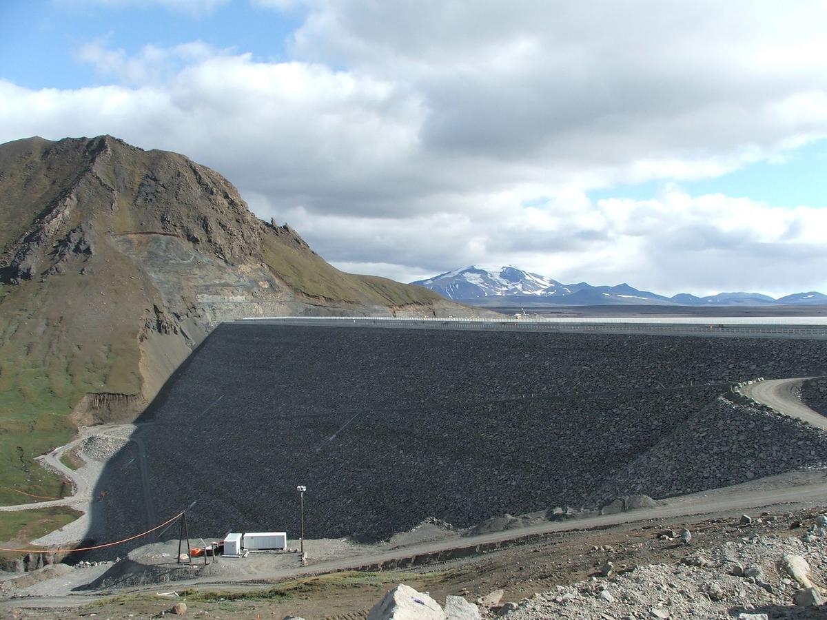
Kárahnjúkastífla
A 198 m-high rockfill dam in Iceland’s eastern Highlands, overlooking Hálslón reservoir and the dramatic Hafrahvammagljúfur canyon.
At a Glance
Visit time
30–60 minutes
Best Season
June–September after Road 910 has opened; clear, calm days give the best views, while Hverfandi appears only when Hálslón is spilling.
Getting There
Road 910 from Fljótsdalur is paved to Kárahnjúkastífla and an ordinary car can reach the dam in suitable summer conditions. Beyond the dam the route becomes F910 and requires a high-clearance 4x4 when officially open. Check current road conditions before departure.
GPS
64.9469, -15.7925
About
About Kárahnjúkastífla
A 198 m-high rockfill dam in Iceland’s eastern Highlands, overlooking Hálslón reservoir and the dramatic Hafrahvammagljúfur canyon.
See one of Iceland’s most imposing engineering structures together with Hálslón reservoir and views into the remote Hafrahvammagljúfur canyon.
Photos
Gallery
Background
History & Background
The Kárahnjúkar hydropower project moved into full construction in 2003 following the energy agreement connected with the Fjardaál aluminium plant in Reyðarfjörður. At the dam site, Jökulsá á Dal was diverted through tunnels while Kárahnjúkastífla was built as a concrete-faced rockfill dam. Filling of Hálslón began on 28 September 2006. During 2006 the final major dam-fill materials were placed and the upstream concrete face was completed; finishing work on the dam crown continued into 2007. Fljótsdalur Power Station entered service in 2007, with its formal start-up on 30 November. The finished system links highland reservoirs, about 72 km of tunnels and an underground powerhouse in Fljótsdalur.
Kárahnjúkastífla is the largest dam in the Kárahnjúkar–Fljótsdalur hydropower system and one of the most striking man-made landmarks in Iceland’s eastern Highlands. The concrete-faced rockfill dam crosses Jökulsá á Dal at Fremri Kárahnjúkar. Landsvirkjun’s current technical data gives a maximum height of 198 metres, a length of 700 metres and approximately 8.4 million cubic metres of fill material. Together with the smaller Desjarárstífla and Sauðárdalsstífla dams, it forms Hálslón, the main storage reservoir for Fljótsdalur Power Station. At full level, Hálslón covers about 63 square kilometres and stretches roughly 25 kilometres through the highlands. Water from the reservoir ultimately travels through the extensive tunnel system to the underground Fljótsdalur Power Station, which came online in 2007. The station has an installed capacity of 690 MW, and much of its electricity has historically been supplied to the aluminium plant in Reyðarfjörður. For travellers, Kárahnjúkastífla is also a dramatic viewpoint. The open highland setting gives wide views across Hálslón, while part of Hafrahvammagljúfur can be seen from the dam area. The canyon reaches about 200 metres in depth at its highest sections. In late summer, when Hálslón is full enough to spill, the overflow creates Hverfandi, a seasonal waterfall that plunges about 100 metres into the canyon. Access is unusually straightforward for a highland landmark when the summer road is open: Road 910 from Fljótsdalur is paved all the way to the dam and can be driven in an ordinary car in suitable conditions. The road beyond the dam becomes F910 and is only for high-clearance 4x4 vehicles when officially open. Weather and road conditions can change quickly, so visitors should check current road information before travelling.
Folklore
Story & Folklore
At Kárahnjúkastífla, the contrast between engineered scale and highland wilderness is unusually direct. Before the hydropower project, Jökulsá á Dal flowed through the Kárahnjúkar landscape toward the deep Hafrahvammagljúfur canyon. Construction of the Kárahnjúkar project began in 2003, and the river was diverted through tunnels while the massive rockfill dam rose across the valley. Filling of Hálslón began in September 2006, and the Fljótsdalur Power Station entered operation in 2007. Today the dam stands 198 metres high and stretches 700 metres across the valley. Behind it lies Hálslón, a reservoir that reaches about 25 kilometres in length when full. The most dramatic moment comes when the reservoir reaches spill level: water is carried toward the canyon edge and becomes Hverfandi, a temporary waterfall dropping roughly 100 metres. The site therefore tells two stories at once — the creation of a major energy system and the continuing force of water, rock and weather in Iceland’s eastern Highlands.
Did You Know?
Kárahnjúkastífla is 198 m high and 700 m long, with about 8.4 million m³ of fill material; when Hálslón spills, the seasonal Hverfandi waterfall appears beside the dam.
Explore
Hidden Gems Nearby
Hverfandi spillway waterfall
When Hálslón reaches its spill level, overflow is directed toward the canyon edge and forms Hverfandi, a seasonal waterfall dropping roughly 100 metres into Hafrahvammagljúfur.
It is temporary rather than a permanent waterfall, so seeing it reveals the reservoir and spillway system in action.
Hafrahvammagljúfur view from the dam
Part of the deep Hafrahvammagljúfur canyon can be seen from the Kárahnjúkar dam area without driving the rougher route to the marked canyon trailhead.
It gives ordinary-car visitors a glimpse into one of East Iceland’s largest highland canyons; reaching the marked trailhead farther on requires a 4x4.
Help
Frequently Asked Questions
Location
Location
Discover
Explore Nearby
Places within 5.0 km
Loading nearby places…
0 places found within 5.0 km
Plan full itinerary →Explore More