
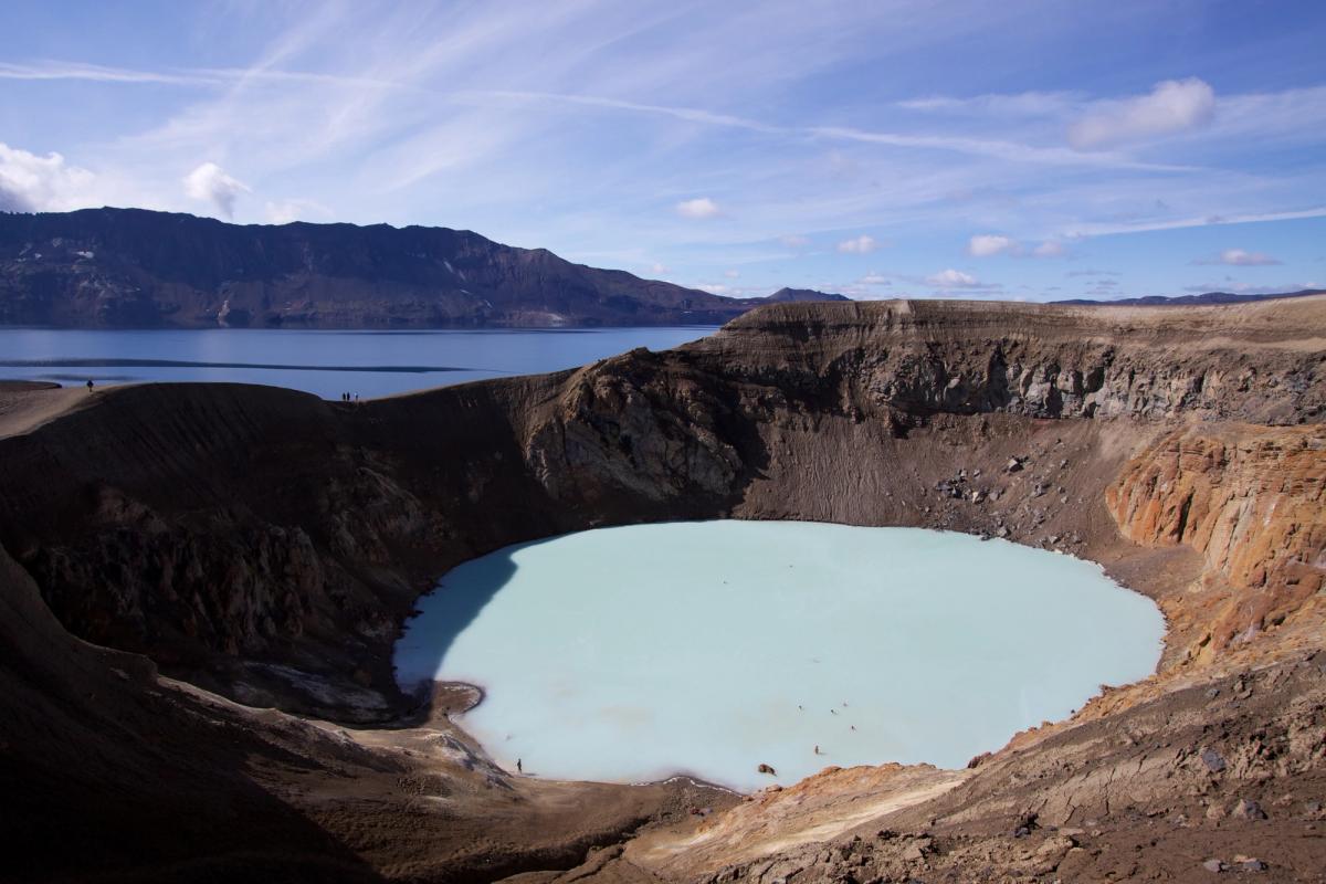
Dyngjufjöll
Volcanic mountain massif surrounding Askja in Iceland’s northeastern Highlands.
At a Glance
Visit time
Several hours for A2; a full day or multi-day plan for longer wilderness routes.
Best Season
Summer, after the Askja Highlands roads have opened and mountain conditions are suitable.
Getting There
Reach the Askja/Dreki area by suitable 4x4. Explore Dyngjufjöll on official marked routes; the A2 route starts at Dreki.
GPS
65.0561, -16.8776
About
About Dyngjufjöll
Volcanic mountain massif surrounding Askja in Iceland’s northeastern Highlands.
See the mountain system that physically frames Askja and hike through raw hyaloclastite, lava and tephra terrain on official national-park routes.
Photos
Gallery
Background
History & Background
Scientific interest in Dyngjufjöll is inseparable from Askja's eruption history and exploration. The massif became especially important to geological study after the major 1875 Askja eruption, and the wider area continues to be monitored as an active volcanic system. Modern visitor access is managed as part of Vatnajökull National Park's Askja and Herðubreiðarlindir area.
Dyngjufjöll is a large volcanic massif in the remote Highlands north of Vatnajökull. Its most famous feature is Askja, the caldera formed within the central volcano. The mountains are composed largely of volcanic material produced in subglacial eruptions and later reshaped by collapse, erosion and subsequent volcanic activity. For visitors, Dyngjufjöll is best understood through the Askja trail network rather than as a drive-up summit. The challenging A2 route climbs from Dreki through the mountain terrain toward Víti, while longer routes connect Dyngjufell with the remote hut network to the north. Access depends on summer Highland-road conditions and visitors should use the official park routes and ranger information.
Folklore
Story & Folklore
Dyngjufjöll and Askja are one volcanic story. During the Ice Age, eruptions beneath thick glacier ice built much of the mountain massif. Later collapse and eruptions formed the deep Askja depression inside it. Today marked routes from Dreki cross the mountains toward Víti, while longer wilderness routes continue through Dyngjufell and toward Suðurárbotnar. The massif is therefore both the geological frame of Askja and a demanding hiking landscape in its own right.
Did You Know?
Askja is not a separate volcano from Dyngjufjöll: it is a caldera within the Dyngjufjöll central-volcano system.
Help
Frequently Asked Questions
Location
Location
Discover
Explore Nearby
Places from our database within 5.0 km — all data from Sanity
Loading nearby places…
0 places found within 5.0 km
Plan full itinerary →Explore More