Capital Region
Kaldárhraun og Gjárnar
About Kaldárhraun og Gjárnar
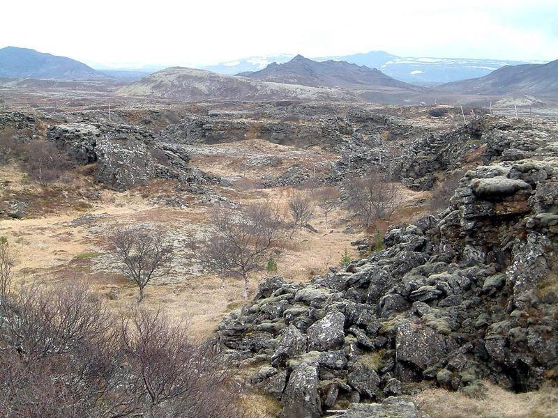
Kaldárhraun and its associated fissures are part of a large lava field located near Hafnarfjörður in Iceland’s Capital Region. The area lies on the Reykjanes Peninsula, one of the most geologically active parts of the country, where the Eurasian and North American tectonic plates are gradually moving apart. The lava field was formed during volcanic eruptions approximately 2,000 to 3,000 years ago. As the lava cooled and solidified, tectonic forces continued to act on the region, creating cracks and fissures—known locally as gjárs—that run through the landscape. These features vary in size and depth, adding complexity and visual interest to the terrain. Over time, moss and other vegetation have slowly colonized the lava, creating a green layer over the dark volcanic rock. This fragile ecosystem develops very slowly and is highly sensitive to disturbance. Today, Kaldárhraun is a popular area for walking and outdoor exploration. Its proximity to urban areas makes it easily accessible, while its geological features provide insight into the natural forces that continue to shape Iceland.
🐉 The Cracks Beneath
Some say the fissures in Kaldárhraun are more than just geological features. On quiet days, when the wind fades, the cracks seem to absorb sound, creating an unusual stillness. Visitors have described standing near the edge of a fissure and feeling a strange depth—not just physical, but atmospheric. It’s as if the land holds something beneath the surface. Whether imagination or the lingering sense of geological power, the feeling remains: this is a place where the earth is not entirely at rest.
📖 History of Kaldárhraun og Gjárnar
Kaldárhraun was formed by volcanic eruptions on the Reykjanes Peninsula roughly 2,000–3,000 years ago. The area lies along the boundary between the Eurasian and North American tectonic plates, where ongoing geological activity continues to shape the landscape. Today, it is an important geological site, offering insight into volcanic processes and tectonic movement in Iceland.
✈️ Why Visit
A raw volcanic landscape with deep fissures and peaceful hiking areas close to Reykjavík.
💡 Did You Know?
The lava field formed around 2,000–3,000 years ago, and the fissures developed as the Earth’s crust slowly pulled apart along tectonic boundaries.
Key Facts
Iceland was formed by volcanic activity approximately 16-18 million years ago
Kaldárhraun og Gjárnar showcases Iceland's remarkable geological diversity
Iceland sits where the Eurasian and North American tectonic plates meet
📍 GPS Location
Explore Tours Near Kaldárhraun og Gjárnar
Find guided tours, day trips and activities. Compare prices and book instantly with free cancellation.