
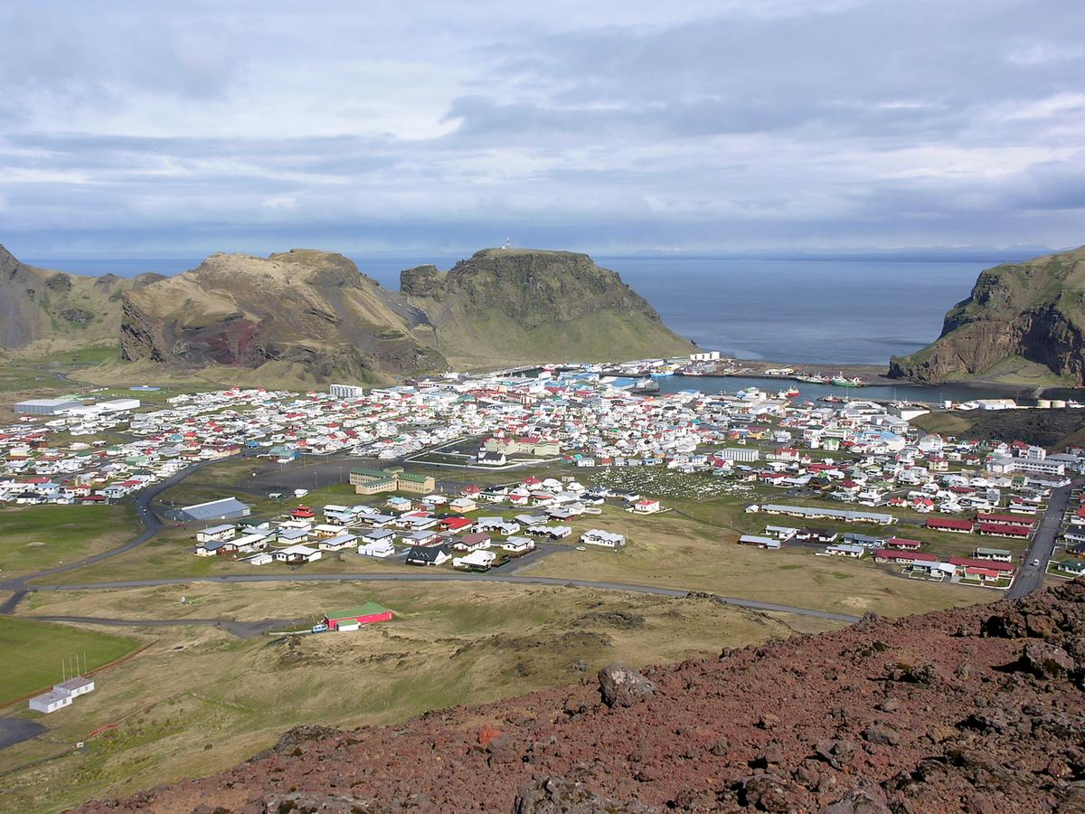
Vestmannaeyjar — Westman Islands
Volcanic archipelago off South Iceland, with Heimaey as the inhabited visitor hub.
について
Vestmannaeyjar — Westman Islandsについて
Volcanic archipelago off South Iceland, with Heimaey as the inhabited visitor hub.
Vestmannaeyjar — Westman Islandsへレンタカーで
車で訪れる予定ですか?地域に合う車種を比較し、旅行日程に応じた実際のレンタカー料金を確認できます。
ここでリアルタイムの空車を検索
車種は提案であり、リアルタイムの料金や在庫ではありません。GoIceTravelは追加費用なしで紹介料を受け取る場合があります。
写真
ギャラリー
背景
歴史と背景
The Vestmannaeyjar archipelago is geologically young, formed by submarine volcanic eruptions over the past 10,000–12,000 years as an active part of the South Iceland volcanic zone. This continuous geological activity has sculpted the islands into their dramatic and unique landscapes. A significant recent event was the emergence of Surtsey between 1963 and 1967, a new island formed entirely by volcanic eruption, which gives rare insight into the birth of landmasses. According to the ancient Icelandic saga, Landnámabók, the islands received their intriguing name, Vestmannaeyjar (Islands of the Westmen), after Irish slaves ("Westmen") of Ingólfur Arnarson's foster brother, Hjörleifur Hróðmarsson, were killed there following their murder of Hjörleifur. The first recorded settler on Heimaey, the largest and only inhabited island, was Herjólfur Bárðarson, who established his home in Herjólfsdalur, marking the beginning of human habitation on these remote islands. The most impactful event in recent history was the 1973 Eldfell eruption on Heimaey. This sudden volcanic outburst threatened to bury the entire town, leading to a dramatic evacuation and an extraordinary effort by the islanders to cool the advancing lava flows with seawater, saving much of their community. This event profoundly shaped the island's landscape and its people, becoming a testament to their resilience and deep connection to their volatile home.
Vestmannaeyjar combines steep sea cliffs, young volcanic landscapes and important seabird habitat. Heimaey is the main inhabited island and was dramatically reshaped by the 1973 Eldfell eruption. The archipelago also includes Surtsey, which formed during the 1963–1967 eruption and is protected for scientific research. The map point is placed in Vestmannaeyjar town on Heimaey as the useful visitor destination rather than at an abstract archipelago centroid.
場所
場所
Plan Your Visit
South Coast Tours Iceland →もっと探索