Hengill Geothermal Area
Active volcanic and geothermal mountain system south of Þingvallavatn.
At a Glance
Visit time
Allow 2-3 hours for a shorter hike, or a full day for more extensive exploration like the Hengill summit.
Best season
Summer (June-August) for hiking, Morning or late afternoon for fewer crowds.
Access
Accessible via Route 1 (Ring Road) with turn-offs onto mountain roads. Parking is available at trailheads. Some mountain roads may require a 4WD vehicle.
GPS
64.0838, -21.3162
About
About Hengill Geothermal Area
Active volcanic and geothermal mountain system south of Þingvallavatn.
Explore a broad volcanic landscape where geothermal activity, tectonic structures and mountain hiking meet.
Photos
Photo Gallery
Background
History & Background
Hengill is an active volcanic system, making it a significant geological landmark in Iceland. Its formation is tied to the movement of tectonic plates, lying on the rift zone where the North American and Eurasian plates diverge. This constant geological activity has shaped Hengill into the prominent volcanic table mountain it is today, characterized by intense geothermal phenomena. Evidence of this activity, such as the steaming vents and hot springs, has been present for millennia, shaping both the landscape and local understanding of the earth's power. The area's history is predominantly geological, reflecting ongoing volcanic processes rather than human habitation or historical events.
The Hengill area covers a broad volcanic and geothermal landscape between Þingvellir, Nesjavellir and Hellisheiði. The system includes geothermal surface activity and a network of hiking routes. Conditions and road access vary across the area, and visitors should use marked trails and current local information rather than treating a single map point as a geothermal bathing site.
Folklore
Story & Folklore
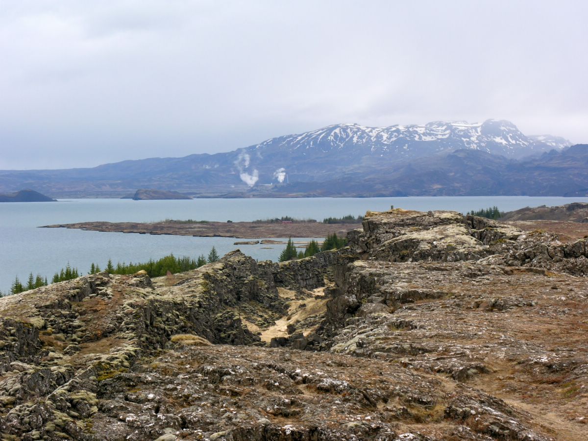
The air hums with a primal energy at Hengill. Standing amidst the rugged, moss-covered fissures that crisscross the landscape, as captured in the image, you feel the earth breathing. Wisps of steam rise from hidden vents, carrying the distinct scent of sulfur, a constant reminder of the volcanic might beneath your feet. The terrain, a patchwork of vibrant green moss and dark, cracked rock, slopes down towards a serene, vast lake that mirrors the overcast sky. In the distance, snow-dusted mountains loom majestically, their peaks often shrouded in mist. It's a place where the raw power of nature is palpable, where every step on the ancient lava fields feels like a journey through geological time, leaving an indelible mark on your soul.
💡 Did You Know?
The name 'Hengill' may derive from an old Icelandic word meaning 'hanging' or 'suspended,' possibly referring to the mountain's appearance.
Explore
Hidden Gems Nearby
✦ Reykjadalur (Hot Spring River Valley)
A picturesque valley where a warm river flows, perfect for bathing in natural hot springs. The hike to the river is moderately easy and incredibly rewarding.
It's a unique opportunity to bathe in a naturally heated river in a stunning, wild setting.
✦ Hengill Summit (803m)
Embark on a challenging hike to the peak of Hengill mountain, offering unparalleled panoramic views of the surrounding geothermal area, lakes, and distant mountains.
The summit provides the most breathtaking and expansive views of the entire region.
✦ Nesjavellir Geothermal Area
Explore another part of the Hengill system, home to one of Iceland's largest geothermal power plants and impressive steam vents. It's an excellent spot to observe industrial-scale harnessing of geothermal energy.
Witness firsthand the powerful intersection of nature and human innovation in energy production.
Help
Frequently Asked Questions
Location
📍 Location
Discover
Explore Nearby
Places from our database within 1.0 km — all data from Sanity
Loading nearby places…
0 places found within 1.0 km
Plan full itinerary →Explore More