
Dyngjufjöll
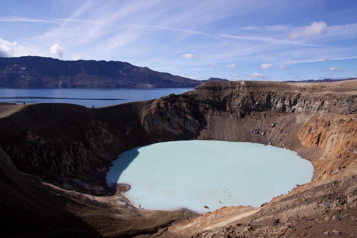
Volcanic mountain massif surrounding Askja in Iceland’s northeastern Highlands.
概要
訪問時間
Several hours for A2; a full day or multi-day plan for longer wilderness routes.
最適な季節:
Summer, after the Askja Highlands roads have opened and mountain conditions are suitable.
アクセス
Reach the Askja/Dreki area by suitable 4x4. Explore Dyngjufjöll on official marked routes; the A2 route starts at Dreki.
GPS
65.0561, -16.8776
について
Dyngjufjöllについて
Volcanic mountain massif surrounding Askja in Iceland’s northeastern Highlands.
Dyngjufjöllへレンタカーで
車で訪れる予定ですか?地域に合う車種を比較し、旅行日程に応じた実際のレンタカー料金を確認できます。
ここでリアルタイムの空車を検索
重要:4WD/AWD であっても Fロードの走行が許可されるとは限りません。正確なルート、車両、レンタル契約をレンタカー会社にご確認ください。4WD でも閉鎖道路や渡河が禁止されている場合があります。
車種は提案であり、リアルタイムの料金や在庫ではありません。GoIceTravelは追加費用なしで紹介料を受け取る場合があります。
写真
ギャラリー
背景
歴史と背景
Scientific interest in Dyngjufjöll is inseparable from Askja's eruption history and exploration. The massif became especially important to geological study after the major 1875 Askja eruption, and the wider area continues to be monitored as an active volcanic system. Modern visitor access is managed as part of Vatnajökull National Park's Askja and Herðubreiðarlindir area.
Dyngjufjöll is a large volcanic massif in the remote Highlands north of Vatnajökull. Its most famous feature is Askja, the caldera formed within the central volcano. The mountains are composed largely of volcanic material produced in subglacial eruptions and later reshaped by collapse, erosion and subsequent volcanic activity. For visitors, Dyngjufjöll is best understood through the Askja trail network rather than as a drive-up summit. The challenging A2 route climbs from Dreki through the mountain terrain toward Víti, while longer routes connect Dyngjufell with the remote hut network to the north. Access depends on summer Highland-road conditions and visitors should use the official park routes and ranger information.
民話
物語と民話
Dyngjufjöll and Askja are one volcanic story. During the Ice Age, eruptions beneath thick glacier ice built much of the mountain massif. Later collapse and eruptions formed the deep Askja depression inside it. Today marked routes from Dreki cross the mountains toward Víti, while longer wilderness routes continue through Dyngjufell and toward Suðurárbotnar. The massif is therefore both the geological frame of Askja and a demanding hiking landscape in its own right.
場所
場所
もっと探索