
Díma í Lóni
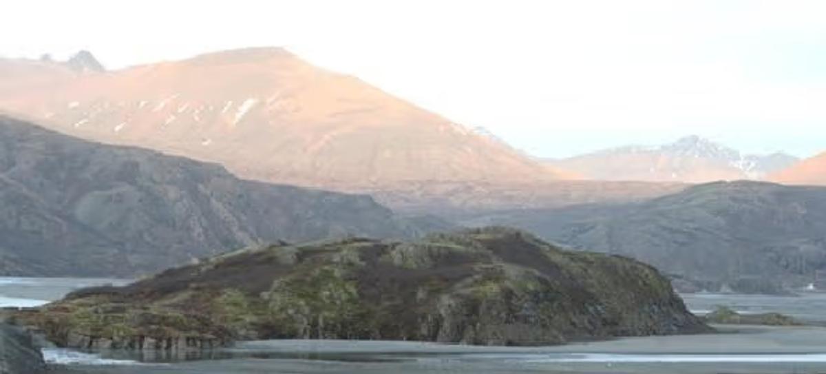
A captivating rocky outcrop, sculpted by the Jökulsá river, standing proud in East Iceland.
概要
訪問時間
1 hour
最適な季節:
Late Spring to Early Autumn (May-September) for best weather and visibility. Morning or late afternoon for optimal light for photography.
アクセス
Accessible via a paved road leading into the Lóni valley, followed by a short walk along a protective embankment from the southwest side. Parking is usually available nearby.
GPS
64.4314, -14.9344
について
Díma í Lóniについて
A captivating rocky outcrop, sculpted by the Jökulsá river, standing proud in East Iceland.
Díma í Lóniへレンタカーで
車で訪れる予定ですか?地域に合う車種を比較し、旅行日程に応じた実際のレンタカー料金を確認できます。
ここでリアルタイムの空車を検索
車種は提案であり、リアルタイムの料金や在庫ではありません。GoIceTravelは追加費用なしで紹介料を受け取る場合があります。
写真
ギャラリー
背景
歴史と背景
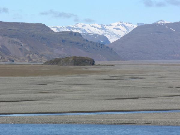
Díma í Lóni holds significant natural and historical importance, officially declared a natural monument in 1975 to protect its unique geological features and diverse vegetation. This rocky hill, situated amidst the expansive river sands of Jökulsá in Lóni, has long been recognized as an iconic landmark in the region. Historically, Díma has functioned as a natural boundary, delineating the lands between the farms of Stafafell and Þórisdalur. Its formation is a compelling narrative of geological processes: it has evidently existed as an island within the Jökulsá river for an extended period, bearing clear evidence of erosion and shaping by the powerful river current. The north side of Díma features a striking vertical cliff, a direct result of the river's persistent flow along its base, while other slopes are also steep, highlighting the river's carving action over millennia. The protective embankment connecting Díma to Dalsfjall from the southwest offers insight into human efforts to interact with and manage this dynamic natural environment, allowing for easier access to this remarkable site.
Díma í Lóni is a truly remarkable geological feature in East Iceland, a testament to the powerful volcanic and tectonic forces that have shaped this dramatic landscape, combined with the relentless erosive power of water. Formed as a rocky hill (klapparhæð) within the vast alluvial plains of the Jökulsá river in Lóni, it has been designated a protected natural monument since 1975, covering an area of 6.4 hectares. The image vividly captures Díma's distinctive form: a rugged, vegetated island-like outcrop rising from the flat riverbed, framed by the majestic, light-bathed mountains in the background. Its unique character stems from its long history as an island in the Jökulsá, bearing clear marks of being scoured and shaped by the river's flow. The northern side features a vertical cliff face where the river actively flows today, showcasing the ongoing geological process. While the western, southern, and eastern slopes are also steep, an accessible path can be found from the southwest, originating from a protective embankment that connects Díma to the nearby Dalsfjall. This makes it approachable for visitors keen to explore its diverse flora and appreciate its stark beauty up close. Díma also serves as a traditional landmark, marking the boundary between the farms of Stafafell and Þórisdalur, further cementing its significance in the local landscape and history.
民話
物語と民話
As the soft, ethereal light of dawn or dusk bathes the Lóni valley, Díma emerges from the mists, a solitary sentinel amidst the braided channels of the Jökulsá river. Imagine standing on the riverbank, the cool air crisp against your face, the distant mountains glowing with a gentle warmth, their peaks still holding patches of snow. The sound of the river, a constant murmur, tells tales of its relentless work, carving, eroding, and shaping this very landscape. Díma, with its rugged, moss-kissed cliffs and verdant slopes, feels like a living testament to time itself. It whispers stories of ancient floods, of a land constantly being reborn, a geological masterpiece sculpted by water and patience, inviting you to ponder the immense power of nature in this tranquil corner of East Iceland.
文化
物語と伝説
この地域のアイスランドのサガと民話
場所
場所
もっと探索