
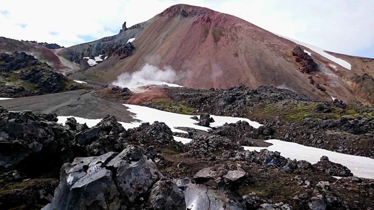
Brennisteinsalda Mountain
Brennisteinsalda, the 'Sulphur Wave,' is a strikingly colorful rhyolite mountain renowned for its vibrant, rainbow-striped mineral slopes and active geothermal …
概要
訪問時間
About 3.5 hours for the 7 km official route.
最適な季節:
Summer, when Landmannalaugar access and marked trails are open and conditions are suitable.
アクセス
Start from Landmannalaugar and follow the marked trail system. The official Brennisteinsalda route uses part of the Laugavegur before turning toward the summit.
GPS
63.9809, -19.0956
について
Brennisteinsalda Mountainについて
Brennisteinsalda, the 'Sulphur Wave,' is a strikingly colorful rhyolite mountain renowned for its vibrant, rainbow-striped mineral slopes and active geothermal vents in Landmannalaugar.
Brennisteinsalda Mountainへレンタカーで
車で訪れる予定ですか?地域に合う車種を比較し、旅行日程に応じた実際のレンタカー料金を確認できます。
ここでリアルタイムの空車を検索
重要:4WD/AWD であっても Fロードの走行が許可されるとは限りません。正確なルート、車両、レンタル契約をレンタカー会社にご確認ください。4WD でも閉鎖道路や渡河が禁止されている場合があります。
車種は提案であり、リアルタイムの料金や在庫ではありません。GoIceTravelは追加費用なしで紹介料を受け取る場合があります。
写真
ギャラリー
背景
歴史と背景
Brennisteinsalda's history is deeply intertwined with Iceland's dynamic geology. As an active rhyolitic lava dome, it forms part of the expansive Torfajökull volcanic system. Its very existence is a direct consequence of the divergent boundary between the North American and Eurasian tectonic plates, a geological hotspot that fuels its vibrant geothermal activity, evident in the hot sulfur springs and vapor plumes. The last significant eruption linked to Brennisteinsalda and the Laugahraun obsidian lava field at its base is believed to have occurred around 1477 AD, with some historical accounts suggesting an earlier date of 1341. Beyond its dramatic geological past, the Landmannalaugar region, where Brennisteinsalda proudly stands, holds a more human history. Early Icelandic settlers likely recognized and utilized the area's abundant geothermal hot springs for practical purposes such as bathing and washing. This connection highlights the enduring relationship between humans and the powerful natural resources of Iceland, making Brennisteinsalda not just a geological spectacle but also a place with echoes of ancient human resilience and adaptation.
Brennisteinsalda is a colourful rhyolite mountain in the Landmannalaugar area, shaped by volcanic and geothermal processes. Its slopes show contrasting mineral colours and geothermal activity. Hiking routes in the area are exposed to rapidly changing highland weather, so visitors should follow marked routes and current local guidance.
場所
場所
もっと探索