
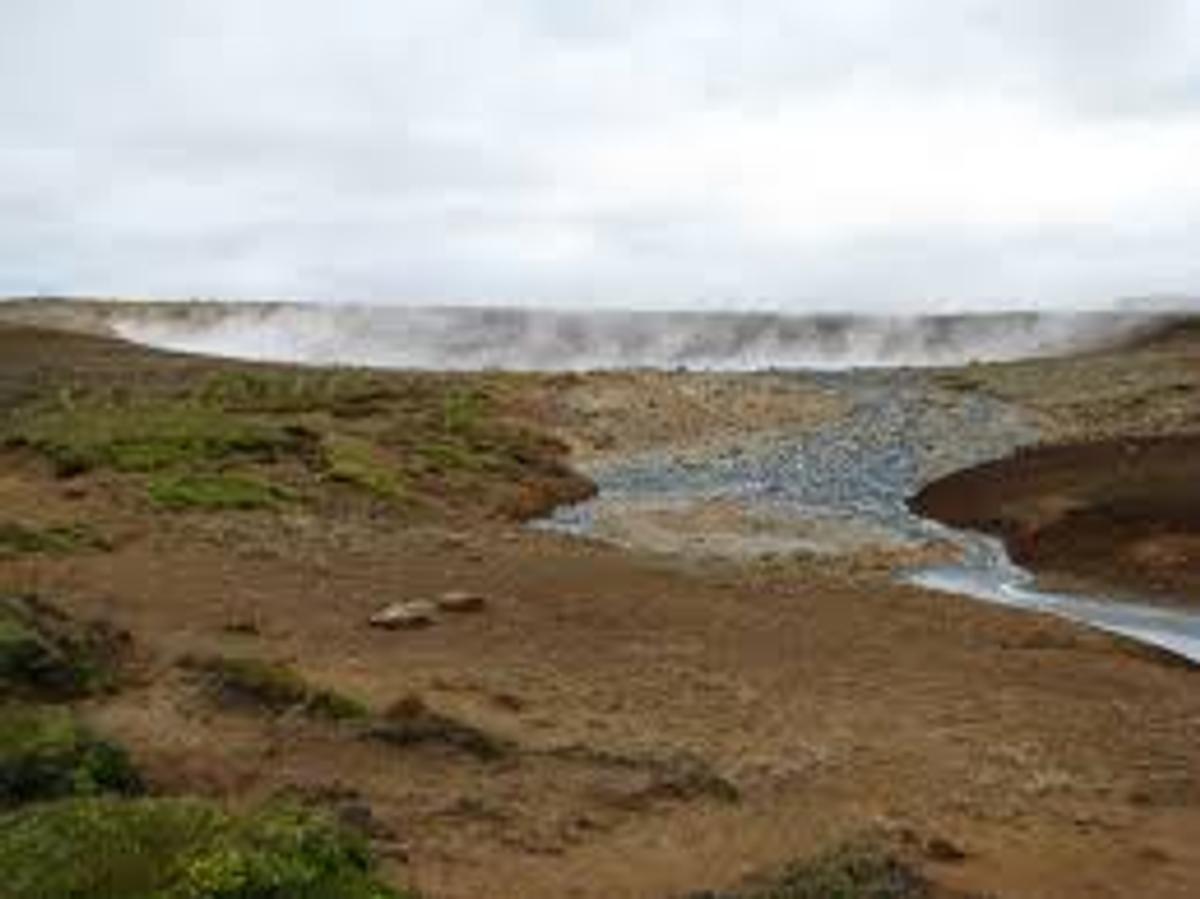
Austurengjahver
An active geothermal mud spring in the Austurengjar area south of Kleifarvatn, part of the wider Krýsuvík high-temperature geothermal system.
De un vistazo
Tiempo de visita
Allow 30–60 minutes, usually as part of a wider Krýsuvík or Kleifarvatn outing.
Mejor temporada
Dry, clear conditions make undeveloped geothermal terrain easier to assess.
Cómo llegar
The Austurengjar area is less developed than Seltún. Use established access only and never cross geothermal crusts or steaming ground.
GPS
63.8973, -22.0137
Acerca de
Sobre Austurengjahver
An active geothermal mud spring in the Austurengjar area south of Kleifarvatn, part of the wider Krýsuvík high-temperature geothermal system.
Tours cerca de Austurengjahver

South Coast Tour - Black Sand Beach, Plane wreck, Skogafoss, Seljalandsfoss guided in Chinese冰岛南岸黑沙滩飞机残骸中文一日团
Magic Iceland Travel · 10 hours 30 minutes
DT 322 Private Superjeep South Coast & Eyjafjallajökull Volcano Sights
Superjeep · 8 hours
South Coast Small Group Tour: Waterfalls, Glacier & Black Sand Beach
BusTravel Iceland · 10 hours
South Coast Waterfalls, Black Beach and Glacier Adventure | Small Group Day Tour
Nicetravel · 11 hours
Visita Austurengjahver en coche
¿Vas a conducir hasta aquí? Compara vehículos adecuados para la región y consulta ofertas para tus fechas.
Busca disponibilidad real aquí
Los tipos de coche son sugerencias, no precios ni disponibilidad en tiempo real. GoIceTravel puede recibir una comisión sin coste adicional.
Fotos
Galería
Antecedentes
Historia y Antecedentes
Austurengjar has long been recognised as one of the principal geothermal areas in the Krýsuvík district. The wider Krýsuvík landscape was historically a farming and travel area, while modern geological study has focused on its high-temperature system, earthquake activity and changing geothermal surface features.
Austurengjahver lies in the Austurengjar geothermal area south of Kleifarvatn, within the broad volcanic and geothermal landscape of Krýsuvík. Visit Reykjanes lists Austurengjar among the main high-temperature geothermal areas of Krýsuvík, together with Seltún, Hverahvammur, Hverahlíð and geothermal ground along the southern part of Kleifarvatn. The feature is an active mud spring where hot groundwater, gases and fine volcanic material interact close to the surface. Bubbling mud and rising steam are visible evidence that the Reykjanes Peninsula remains geologically active along the plate boundary. The surrounding area also contains explosion craters, lakes, old farm remains and other geothermal features, making Austurengjahver part of a much larger geological story rather than an isolated hot spring. The ground around geothermal features can be unstable and much hotter than it appears. Visitors should never test the surface with hands or feet, should avoid walking on pale or steaming ground outside established routes and must respect any barriers or closures. Austurengjahver is best suited to travellers already exploring Krýsuvík and the quieter landscapes south of Kleifarvatn rather than those looking for developed visitor facilities.
Folclore
Historia y Folclore
Austurengjahver is part of a landscape where the surface gives only small clues to the heat below. Steam escapes through cracks, mineral-rich water alters the ground and mud bubbles where groundwater meets volcanic heat. Across Krýsuvík, these features shift over time as earthquakes and changes in underground water pathways alter where pressure reaches the surface. The mud spring is therefore not a static landmark. It belongs to an active geothermal system that also feeds nearby hot ground and springs around Kleifarvatn and Seltún. Visiting it offers a quieter look at the same processes that shape the peninsula's better-known geothermal sites.
Ubicación
Ubicación
Descubre
Explora los alrededores
Lugares a menos de 5.0 km
Cargando lugares cercanos…
0 lugares encontrados a menos de 5.0 km
Planificar el itinerario completo →Explorar más